From Mayan Yucatan To Idaho and Home
Excerpts from the Log of "Barefoot" Goldwinging
I take pen in hand again to continue the saga. In the previous page I had just left the Uxmal ruins, Santa Elena and the Kabah ruins in Campeche State of Mexico.
From Santa Elena the landform turned from flat limestone plain to low rolling hills with red soil and flat fields in the valleys, well tended, tall grass and nice clean little villages, winding roads in good condition. As the sun rose to its zenith at noon, the temperature was close to 100º in the sun and 90º in the shade. I stopped along the road to refill my water jug from an irrigation well that was flowing over the top of the casing standing about 6 feet out of the ground. I filled the bottle, doused my head and cooled off a bit in the shade.
Arriving in El Centro de Campeche, it is a beautiful walled colonial city dating from 1540, that puts the French Quarter of New Orleans to shame. All the structures were beautifully stuccoed in pastels, extremely well maintained. My back had been bothering me a little, having twisted myself somehow while climbing up, over and around the ruins at Chichen Itza. I contented myself for the first hour in Campeche with sitting in the shade of the plaza, walking around a few blocks to an icecream/sandwich shop, a chocolate double dip sundae, and back to the shade of the plaza to eat it. While in the shop, two exquisitely beautiful young ladies came in, long legged, tall, 5'6", well shaped and well dressed, definitely not Maya, but Indian admixture for sure. I have not figured out the genetic stock that produces this beauty, tall and lithe.
School kids came to the plaza during a recess and the teams of boys and girls played soccer until time to return to class. The sky clouded over about 2:30, cooling down a little. I rode around town a little, then south and west out of Campeche about 15 klicks, where I found a cutoff piece of highway that was abandoned due to cave-in and washouts from the hurricane that had hit the area a couple of years before. I found a trail down to it, rode back along it about 1 1/2 klicks, figuring I could camp along it somewhere and go swimming in the Gulf. I found an abandoned beach house, 3 rooms, about 25 x 30, one room of which had a bed platform. I parked the bike out of sight, went down to the beach and soaked my feet, cooled off, hauled my gear in and setup camp in the house. After I inflated my air mattress I stripped down and sacked out for siesta about 4:30. The cool breeze coming in the window - or where the window had been - was very welcome.
All the fixtures and tile had been stripped from the beach house, leaving nothing but an empty concrete shell, but rain and wind had kept it blown clean. On awakening from my siesta I took a dip and a swim to wash off 3 days of sweat, rinsing the salt water off with a couple of cups of fresh water from my water jug and a hand towel, not quite like a shower, but a whole lot better than nothing. I felt a bunch cleaner, and with the breeze coming up off the Gulf, a whole lot cooler. The breeze was kicking up 1 and a half foot waves where there had been none when I arrived. I made myself a cup of coffee and laid back down to practice doing nothing until morning. I woke again about 9, got my candle for light. The wind had died and reversed, a gentle breeze back out to sea. I sat up enjoying the evening and watching the lights of fishing boats for about a half hour, laid back down and slept until morning.
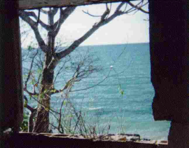 The View From My Window | 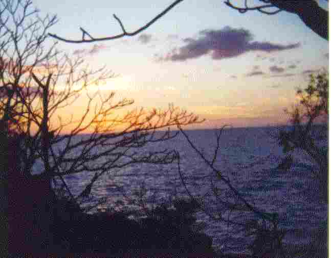 Sunset | 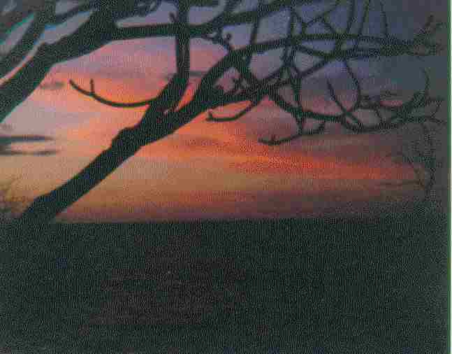 The End Of Day |
|---|
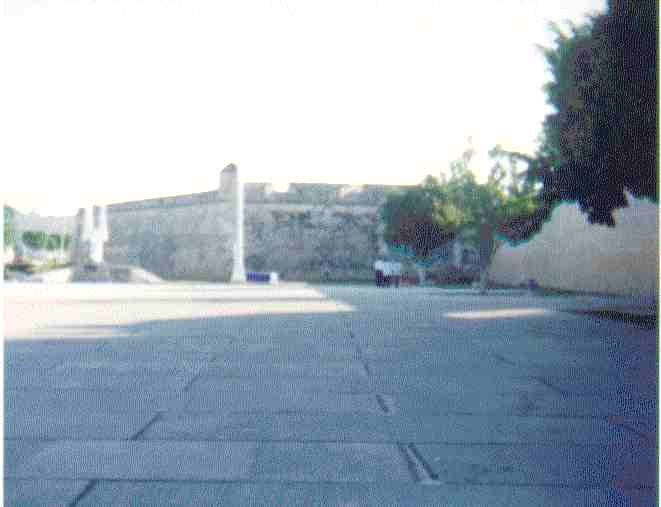
When I awoke, the day was just beginning to break. I made coffee, put on clean clothes and sat and smoked, the sea and wind quiet. I watched many troups of brown pelican passing by. I loaded the gear back on the bike, and rode back to Campeche, stopping to look at the old Spanish Fort on top of the hill to the south west of town about a mile. It was not open for visitors yet. Riding on in to the old section of town, I parked in the banking section at the end of a remnant of the old city fortification wall. I went into a Banamex to an ATM, but my funds had not been posted yet at home. I am in Eastern Standard Time, and my deposit is posted Pacific Standard Time..will have to wait.
Where I was parked, a band drill team was drilling and acting like kids - screwing off while the instructor had a few fits. I went to breakfast a half block away to wait out the ATM and deposit. The hostess was a beautiful girl, Sally (Betty) Gonzales, who spoke English well and was most charming and gracious. I had coffee and a continental breakfast. Excellent clean restaurant, Marganzo, Calle 8 No. 267, I highly recommend eating here. I am always amazed at the sweetness of the Mexican people and of the sweetness of the fresh squeezed orange juice wherever I have been. The restaurant was very busy with local business people, the conversation lively, the waitresses in long skirted Mayan dresses and blouses, and on the ball with extra coffee. Business men gather here for breakfast to discuss the days affairs - muy simpatico. I see only one couple besides myself who are obviously tourists, I would guess French or Italian. I wandered around the restaurant before leaving, looking at pictures of Campeche at the turn of the century...
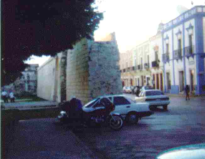 In Campeche Parked at End of Wall |  A Main Gate In the Fortification Wall | 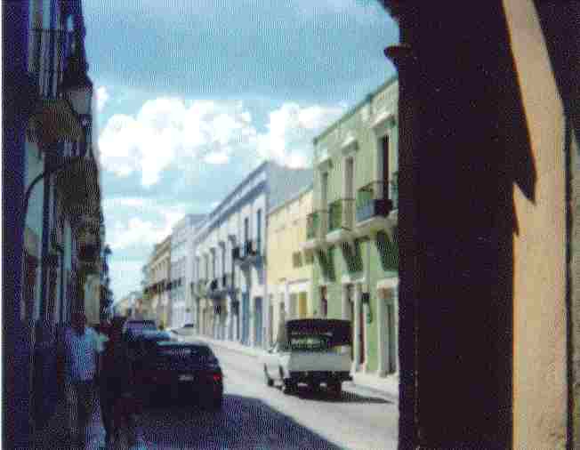 Calle 8 In Old Section Of Campeche |
|---|---|---|
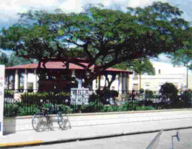 The Park Pavillion In The Plaza | 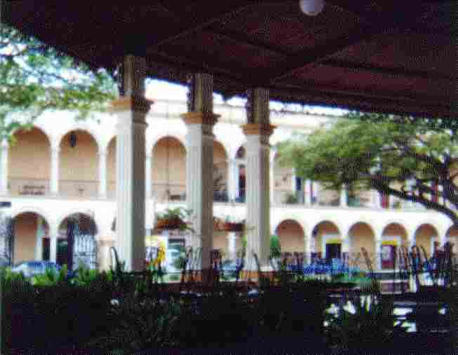 The Pavilion Looking Out Across Calle 8 | 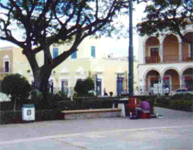 The Corner and The Shoeshine Boy |
 The Outer Plaza Soccer and Drill Field |  The Cathedral Facing the Plaza |  The Cathedral Re-Stuccoed Section Of Wall |
I checked the ATM again, not yet, sat and watched boys playing soccer again in the plaza during recess... with the normal horseplay of high school boys... checked the ATM and drew $2000 pesos. I could fill up the tank on the cycle again and proceed on my way up the coast. I stopped on my way out of town at the Reducto de San Miguel, the fort on top of the hill. It is a worthwhile tour, the guide spoke fair English, giving me a better understanding of the Mayan culture and the well preserved Spanish Fort.
 Reducto de San Miguel The Drawbridge and Portal | 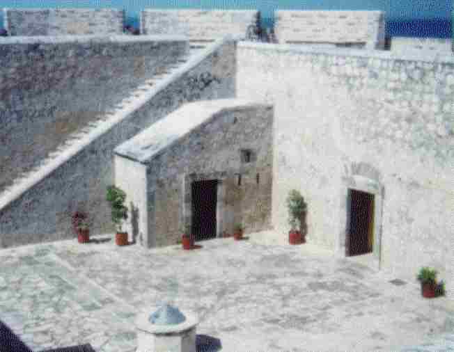 Inside the Fort | 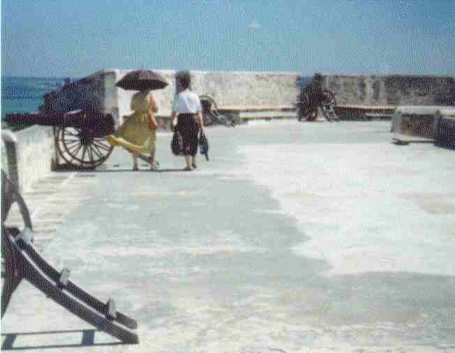 On The Parapet Ladies Strolling, Airing in the Sun |
|---|
On up the coast, mile after mile of coral/limestone beach once lined with coconut palms, but now replanted for the most part with small palms, to Cd. Del Carmen and inland 30 miles, palm trunks with top whipped off, all broken off by the hurricane. Crossing the bridge across the lagoon coming into Cd. Del Carmen I got nailed by the highway patrol. I was doing 25 mph instead of the 30 km/hr as posted, a $50US fine. It is posted 30 km/hr, 18 mph, and they mean it - pay heed - it is patrolled constantly - it is in poor shape from the hurricane and harmonics of cars or vehicles going faster get it to shaking. The patrolmen were nice enough, but weren't taking any excuses.
Passing through Frontera I stopped for an early dinner, 1/2 chicken and the fixin's 25 pesos. I continued on after dark, not finding a hotel or motel, to Paraiso, then to Comacalco, where I found Los Pinos Motel, exquisite rooms, security, private locked garages, 100 pesos, $10US, recommended highly.
I showed up at the gate of the Comacalco ruins in the morning, 2 hours early. While I was waiting I fixed the cruising pegs on the bike, wiped it down, set up the idle speed, as it was running rough at low speeds. I switched to Pemex Premium, in hopes that it would help. The site at Comalcalco is Toltec and Maya influenced. The name Comacalco means 'in the place of the House of the Coamales'. The complex is oriented to the cardinal Points. Most structures are built of bricks covered with stucco, some still visible.
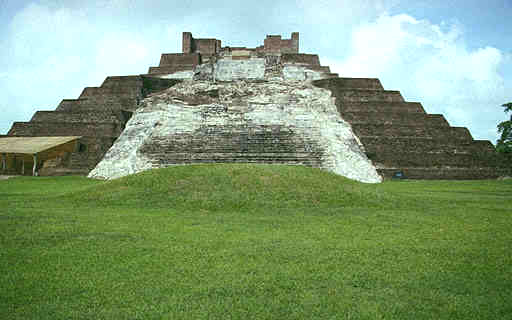 Great Acropolis On Main Pyramid Awning Covers Beautiful Masks |  Great Acropolis 80m Long by 8m Wide | 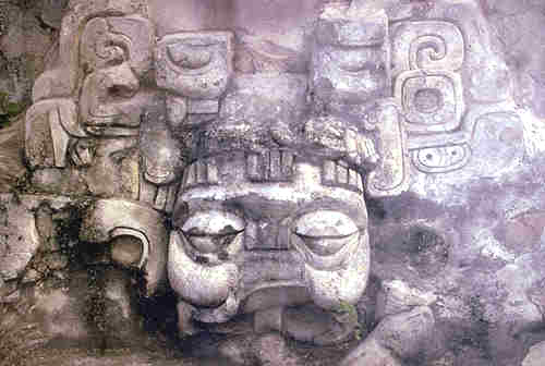 Beautiful Stucco Mask In High Palenque Style |
|---|
The area surrounding Comalcalco and from Guerrero appeared to be affluent ranch and farmland with almost Yankee urban areas, except the older areas of towns which are typical Spanish architecture.
I rode for 2 hours through beautiful productive and well kept farmland, somewhat like Louisiana and East Texas, but with much more varied crops, cane, corn, avocados, oranges and other citrus, fruiting trees and flowering trees, pasture and range land good for 1-1 1/2 acre per cow. - productive. It is a prosperous area, freeways being buillt, road in good repair.
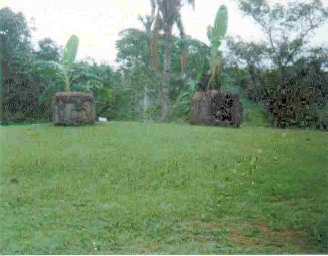
I turned off to the La Venta ruins. This is the ruins with the BIG Stone Heads .. 6 foot in diameter and 8 foot tall .. the ones you see in encyclopedias.. they are carved figures of the Olmec, dating from 1200-1400BC. There was one unrestored pyramid mound of clay and sand, undisturbed in a beautiful park setting. A number of raised platforms and mounds surrounding. The stone used for monuments is not native, but lava and serpentine transported by river raft for several hundred kilometers.
 The Entrance Park at La Venta | 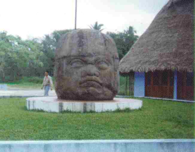 The Big Head | 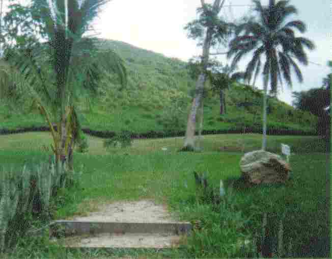 Unrestored Pyramid |
|---|---|---|
 Heads Around The Park |  A Carved Monolith | 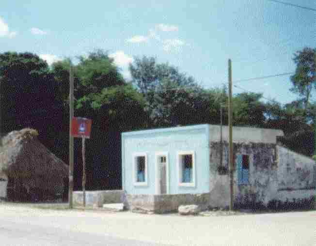 El Grupo Meeting Hall |
Next day was overcast, in the 80's, a welcome relief, as I continued up the coast into Veracruz State. The landform changes to uplifted eroded rolling hills, 40-50 meters high, for about 30 klicks into Coatacoalcos, then leaving there changes to a flat sedge land, a river delta, that the Japanese or Chinese would grow a billion tons of rice on.
I stopped in the little town of Acayucan for lunch, the overcast beginning to open up, warming to the 90's. I took siesta for an hour and a half in the shade, checking my maps. I was still 120 miles out of Veracruz. I am still amazed, with all the open air restaurants, I have seen virtually no flies. I think I have only swatted 2 or 3 in all of Mexico.
The beauty of Veracruz State exceeds that of anything I had seen yet, especially topping over the pass and the first view of Laguna Catemaco, a large lake about 8 by 11 kilometers and only 20 kilometers from the coast of the Bahia de Campeche in the Golfo de Mexico, and surrounded by mountains a 1000 meters high, lush, verdant, and serene. Catemaco is a very clean town of about 35,000, very beautiful, one of the "Green" communities of Mexico. Tucked away on the eastern shore of Laguna Catemaco, high in the jungle-covered Tuxtla Mountains along the Gulf of Mexico, the town definitely has a mystical feel. Catemaco is not only a very unique and beautiful town, it is the witchcraft capital of Mexico - and some say of the world. It is the meeting point for Mexico's Witches. They meet once a year at Monkey Island and trade their spelling secrets in order to enhance their magical powers.
The people here are grading away from the Maya, a taller, more lithe people. The kids in the taco stand where I stopped for a coke and a bite to eat, got a kick out of my broken spanish (which I speak perfectly and fluently) and my Spanish study books. I moved the bike to the shade and let the kids, Anna, Tin, Jorge and Alfredo, study my books.
I arrived in Veracruz just before dusk, circled around trying to find the zocalo, found a waterfront esplanade at the lighthouse. I parked across from the Cafe Del Faro, had 3 cups of excellent coffee and ensalada de frutas, a good plate full of papaya, cantaloupe, peaches, watermelon and pineapple. It is a first class establishment. I sat, watching the crowd until 8:30, a big freighter in the slip opposite, loading and unloading cargo. Veracruz is a busy big port with excellent harbor. It is a thoroughly modern city with a Mexican flair. One thing of note - the street vendors we see at border towns are common throughout Mexico - that is how small wares are peddled, most produce, refreshments, hand crafts and meals. Most of the cars in Veracruz are of 90's vintage and in excellent condition, polished. Police circled the esplanade every few minutes, riding 250 Hondas and 4 wheelers, and an occasional car, usually a Nissan 4 door, and there are patrolmen on beat. It keeps things very orderly and peaceful. Everything is quite beautiful, artistic and architecturally pleasing to the eye.
Leaving Veracruz about midnight, I located a side road northwest of town about 15 klicks, made camp about a klick off the highway next to a cow pasture. A cane field was burning about a klick away, burning the leaves prior to harvest. A hell of a rain and lightning storm passed through about 5am, lasting about an hour. I went back to sleep for another couple of hours.
I was on the wrong road...had to return about 15k to near Veracruz and take the road southwest that I "thought" was the wrong one. Oh, Well!! In Cardel, I had breakfast of dinky waffles and coffee. It was Friday, and I debated with myself about staying in the Veracruz area until Monday for the Mardi Gras Carnival - No -, I had best head on back toward the States and Home. I circled back to Veracruz to get a better look at the harbor. The wind was a killer, trucks blown over, the sand blowing off the dunes. I made it back to the Malecon, got behind a building next to a real busy cafeteria. Everyone else was getting out of the wind, which didn't seem to be dying down. It seemed to be coming from all directions. Looking around, I don't see one other foreigner, although I can see that some foreign genes have been injected into the local gene pool.
Stuydying my maps, I find I am about 140 miles out of Puebla, via a freeway towards Mexico, D.F. I should be able to skirt D.F. to Teotihuacan and the Tula ruins, then freeway to Aguas Calientes in the next few days, maybe Puebla tonight if the wind stops. For lunch I had Filet de Ranchero, good but hot.. I sure wish I could get a rare steak in Mexico. Counting squares as 60 miles on my map, I am about 2700 miles out of Orange, California and the Friendship Club where I want to be on the 28th of February. This day was the 12th, and the distance equated to 9-12 days of travel even if I have slow going, plenty of time. As it turned out I had a only a day to spare when I reached Orange.
To hell with circling town, I am outta here, it is bad riding in the wind until I got to the Autopista - Freeway - and then for about 40 miles until Cordoba. The road started climbing, drizzling and pea soup fog for 20 miles, and 8000 feet up. I had to stop at 5, freezing cold, stopping in Acultzingo at a restaurante at the top of the pass. Wonder of Wonders, HOT COFFEE and Carne Asada, and out of the cold and rain for a bit. It is 6pm, dark and I may - most likely will - have to hole up here for the night, unless the fog lifts.
The senora is very nice and there are 3 or 4 kids, Carlos 13, Juan Pablo 7, and Mojo, a beautiful little girl 2 1/2. Juan Pablo kept up a constant chatter asking questions, as cute and good a boy as they come. I wished I could communicate with him better, he is like the staccato of a machine gun with his chatter. I had a good dinner and coffee, but I was still chilled. The light in the fog makes it impossible to see ahead and the mist was impenetrable. The fog was not lifting and I was stuck there. I can set up the tent in the barn with the burro if nothing else. Added up the miles, 2300 to Orange.
I whiled away the evening trying to answer Juan Pablo's questions - He is a motormouth and sharp as a tack - picks things up QUICK. About 9:30 Mama and Papa knew I would not be able to continue, offered me one of the kids beds, they double bunking, but I had a better solution. We set the tent up in the corner of the larger room in the hacienda, blew up both air mattresses, got out both sleeping bags, and Juan Pablo and Carlos sacked out in the tent with me. Boy, were they excited, but they fell asleep almost immediately. I got up 4 times in the night, too much coffee.
During the night, trucks passed or stopped constantly, all through the night, jake brakes full on, diesel staccato, brakes squealing, a wonder anyone could sleep, but we did and well. Drivers siphoning diesel and trading from truck to truck to help each other over the pass, or so I assume. Also bringing water to the top of the pass. Two burros passed with two 10 gallon clay ollas in wicker baskets apiece, water going somewhere.
Juan Pablo helped me break down the tent and stow the gear. He needed no instruction. He had carefully observed the order that it came out of the tent bag, helped fold the tent and broke down the tent poles and stowed them perfectly. He and Papa went off somewhere, and Carlos fed the burro and got fire wood and corn for Mama.
I asked the senora when the fog would lift, 2 or 3 days more or less - this is a fogged in world and it seemed to be settling in. I looked outside and saw a mano and metate for grinding their corn tortillas. The senora has a drum top stove on a stone base to cook them on, which I helped her light, and she prepared the bucket of corn that Carlos had brought, grinding the bucketful in less than 5 minutes, and prepared the maize to cook. It didn't take her ten minutes to pat out and cook that bucket full of maize. Mojo came out and burbled at me, cute little girl child, all bundled up.
The senora brought out the pigs feet that Carlos had got for her, which she proceeded to chop up on a block with a machete, placing them in the kettle on the brazier fire. Juan Pablo and Carlos were off somewhere doing chores. Mojo was asking me the names of things and I tried to give her answers. Pigs feet cooking on the old brazier over a wood fire, smelled good. I gave the senora $100pesos for their hospitality and dug out my coveralls, they were completely soaked. Damn!! I wiped off the cycle, back to the fires to warm my hands, wrote out some more of the happenings of the night and morning, gave Carlos a ride on the cycle, waited for Juan Pablo to give him a ride, but the fog was lifting a little by 10am, finished packing and left in the fog about 10:30. My thoughts for the next 1500 miles was how to establish a college trust fund for Juan Pablo, that boy could go far with the opportunity of a good education.
Down the mountain on not too bad curves, following a truck for about 10 miles, and got under the fog and clouds on good 70mph highway and on into Puebla, found an ATM and drew $2000 pesos. I had a good continental breakfast and coffee - a pot - at a "California" restaurant, excellent, clean chain restaurant similar to a Dennys. Out of Puebla at noon, it took me four more hours to find the right way out, circling within 20 miles before I found the back road to Tlaxcala. If anyone finds their way to Tlaxcala, you must poke your nose into Hotel Pasado San Francisco. Elegant and with a display of many Toreador Bullfight Trophie. The overhead skylight and the decor are worth a side trip as is the zocalo and church. The hotel is a little pricey for me, $520 pesos - $52US a night, but equivalent to a $200US hotel with class.
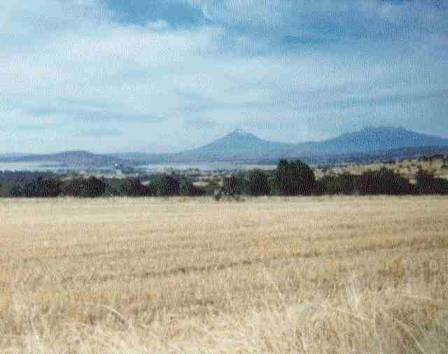
There was a competition and dancing display of Spanish masked dancers around the zocalo, a lead in to Carnival that night. A band of Mariachi started up in the pavillion in the zocalo. I sat and listened for a half hour, admiring the beautifully trimmed and sculpted shrubs and formal designed flower beds. By 5 it was cool enough for my jacket. I went on to Apizaco and got a motel. First class, and a HOT shower that wouldn't quit. I made hot tap water coffee, spread out all the damp gear, and hung up the coveralls. There was no heat in the room that I could find controls for, so I doubled over the blankets on a king size bed. I slept about 9 hours. When I awoke I got out my camp stove and made hot coffee, packed and gone by 8am. Nice clean town. On to Tlaxco and Apan. Good wheat field country, good fat range cattle, big John Deere Agency. I stopped on a rise to warm up, it was frosty, about 35 degrees. Took a picture down the valley of the Popocatepetl Volcano. Popo belched twice after I had shot the picture and that was the last on the roll. It spewed ash and steam in the air about 500 meters.
 Popocatepetl Volcano in Distance, Just beginning an eruption. | 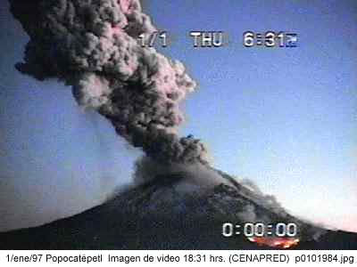 Popocatepetl Official Photo The Eruption of January 1997 |
|---|
A little later on I leaned against a building in the sun to again warm up, while I was waiting for a restaurant to open. The chill at this altitude, about 6000ft., was getting to me even with vest and jacket on. The sky cleared and it warmed into the 60's by 11:30. Breakfast was served with tortilla chips, different, usually steamed corn tortillas, or fresh baked, and a HOT SALSA - habenaro. Out on the sidewalk an 8 year old was trading his baseball and soccer cards with his buddy...the haggling going on would make any street vendor proud.
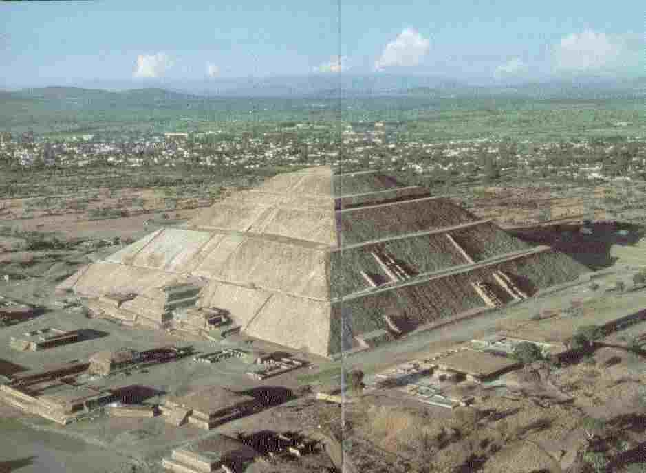
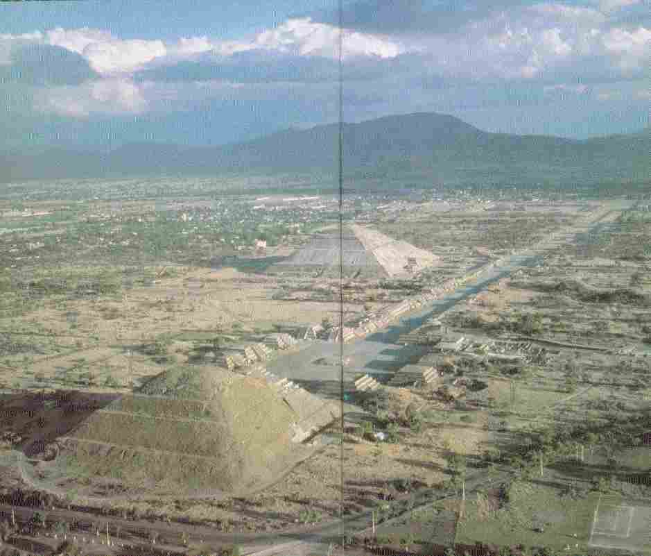
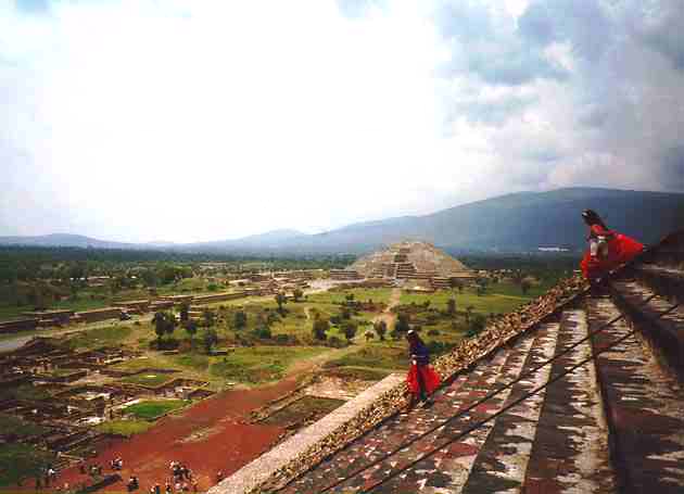
Back on the road to Teotihuacan, arriving about 2:45 after making a slight wrong detour of about 2 miles.. you have to watch those signs. It was Sunday, and all Mexican Ruins are open for free on El Dia del Domingo, thank God. Teotihuacan!!! The Pyramid of the Sun, the Feathered Serpent Pyramid, 200 meters square on the base and 60 meters high, and The Pyramid of the Moon. What I see are the two most impressive stacks of rock I have ever seen. Here is another link to Teotihuacan. And Another. I bought an extra roll of film for $40 pesos and a book on Teotihuacan - $50 pesos. It was now in the 70's in the shade and 80's in the sun, and it was getting more intense by the minute. I climbed the Pyramid of the Sun first off - sheesh - whoozy when I got up, and again when I got down...badly out of 'climbing in the sun' shape. Walked up and down the Avenida del Morte, the Avenue of the Dead, to the Pyramid of the Moon at the north end, admiring the workmanship of the structures lining the Avenida. I was getting too hot so I contented myself reading the book in the shade and looking down the other end of the Avenida with field glasses. After about 3 1/2 hours roasting I decided I needed some wind in my face, so I got back on the bike and headed into Mexico City to join up with the Autopista 57D going north to Queretaro.

On into Mexico City center, the traffic Sunday evening was no problem. I missed my turn, but found my way wandering across town from Ave. Insurgentes to 57D north to Queretara. Out on the highway about 10 miles to fill up at Pemex and put on my jacket, it was getting cold. Another 10 miles to a restaurant and dinner. My jacket zipper had split open, so I sat in the booth for an hour while I repaired the zipper, getting it all linked backed together, one zipper tooth at a time. The road was excellent 4 and 6 lane freeway, moving at 60-70mph, riding on into the night.
I took the first off ramp into Queretaro, found a gravel pit 1/2 mile down, made camp. I was visited by the highway patrol shortly after I had fallen asleep. No problem, they were just checking. They came by twice more during the night to see that I was OK.... No problema, senor.... I just wish they had let me sleep without waking... I really appreciated their concern.
I made coffee and packed up, repaired the zipper again in the morning sun. It had frosted during the night. I entered town and found a Sanborn's Restaurant within a half mile for breakfast. Queretaro is a thoroughly modern city with New Orleans style U-turns at intersections, no left turns allowed at intersections.
The Toll on the freeway is about 1/2 peso per mile and two of the waitresses here at Sanborn's are gorgeous, dressed in "traditional" Aztecan style uniform dresses. There is a substantial middle class here, and the women are long, tall and leggy. The men are handsome, well built and tall, nearly 6 foot on average.
I replaced a tail light bulb that had burned out and headed on toward Leon, Zapotecas, Fresnillo. I had an excellent early dinner, two plates full of chicken fillet and salads, and mints for bed time, in a little town before Zapotecas, when I stopped to lube the clutch cable. The land here is a rich red soil, wheat and corn fields, irrigated from wells and ponds where practical and a lot dry farmed. I recrossed the Tropic of Cancer, the Continental divide and into the Mountain Time Zone within a few miles.
It was good road on to Fresnillo, then 2 lane toward Durango and rough. The fuel filter plugged a few miles out of Fresnillo, I blew it out and was back running, must have got some dirt in the gasoline somewhere. I was starting to run out of daylight, looked for a spot to camp for about 50 miles, then I found a side road that took me down into a basing, found an ideal spot in about a half mile between some nopale cactus and a devil's thorn tree. I got the tent set up just as dark came down. I hung all my rags from the saddle bag on the tree to dry. They got wet when my water bottle leaked.
A coyote kept me company, yipping from the hillside, while I watched my fire burn into the night and the Big Dipper rotate up out of the horizon before sacking out.
I was slow getting started in the morning, my water bottle had frozen during the night, and I seemed to have a slight touch of "La Tourista". I thawed the water and made coffee, cleaned the fuel filter again, lazed around in the morning sun, ate a couple of sweet rolls I had saved, cleaned the bike and put the top and side boxes in order, heated some more water and spit bathed. Got everything in order, and then, dumped the bike within 200 feet in a rut as I was trying to avoid running into a devil's thorn tree. It took me an hour and a half to get it stood back up again. I couldn't figure why I was woozy and blowing so hard.
Out on the road, in a half klick I topped over the pass about 2 klicks from Sombrereto. A roadside sign told me the reason, I was at 2400 meters elevation, about 7900 feet. No wonder I was woozy and blowing hard with the exertion of standing the bike up.
Through Sombrereto I climbed about 300 meters to a flat plain and the Durango State check station where the Federales gave me and the bike a thorough inspection, a nice bunch of kids doing their job searching for contraband drugs and weapons. Then down into the valley of Durango State. 10 miles out of Durango the fuel filter plugged again. I limped into Durango to the Pemex, cleaned the filter thoroughly again, washing it out with clean fuel. On into Durango, sunbaked, windswept and dusty, but becoming modern. Out the other side toward Mazatlan, stopping at the edge of town for a torta at a stand run by a man about my age. A darn good sandwich for $7 pesos. He was making a new sign for his stand, a good sign painter.
No more problems for the day, up and out of Durango across a couple of passes, and THEN....
La Espina del Diablo Highway..... The Going to the Sun Highway in Glacier Park, the Icefields Highway between Jasper and Banff in Canada, and the Tuolomne Meadows Road from the Mojave into Yosemite pale in comparison - The most Awesome mountain granduer and vista I have ever seen. How in hell the Mexicans cut a road through is beyond me. Volcanic Palisades, cliffs straight down 2000 feet down, winding, winding, winding around the cliff sides tenaciously hanging on. A beautiful, inspiring motorcyclist's dream highway, the magnificent handiwork of the Creator laid out right there before us. Heart Pounding, Overloading All Senses.
One hundred miles out of Mazatlan a truck accident blocked all traffic, with only enough space around the end of the nose of the truck for a motorcycle to get around without dropping over the edge into the chasm. So I had the road all to myself. All traffic had been stopped at the bottom of the highway coming out of Mazatlan. And I was out of film... Damn.... hope I can find something on the internet... an absolute MUST for any bike tour of the area...Take lots of film and a day up and down, and warm clothes..... it is an ocho or nueve hour ride each way. If you get stuck behind a slow moving truck or other vehicle, remember that a left blinking tail light is a signal from the driver that it is safe to pass... that is the common courtesy signal throughout Mexico....but easy does it, better safe than sorry.
I was still about 40 miles out of Mazatlan and at 3000 feet when the sun set. I could see the Pacific Ocean on down the mountain valley in the dark. I arrived in Mazatlan about 9:30p, they are going nuts, loco, they have just finished "Carnival". Had dinner watching the revelers, and found a motel a couple of miles from the beach area. I unloaded my gear, and the water ran out just as I was getting ready for a shower. I talked with a couple of locals who had lived and worked in San Diego and El Centro, speaking excellent English. I drained the sink taps and some from the toilet tank for a pot of water, heated it on my camp stove, washed the dust off, made a cup of coffee and sacked out.
In the morning I heated water again for coffee, shaved and took a thorough spit bath, the water still not back on. Put on clean clothes, bundled the dirties, put them in the laundry, and while they were being done, I circled back and through and around Mazatlan and didn't see a thing worth staying for (except some exceptionally beautiful women, but I left anyway). I stopped at a plaza and bought 3 new western shirts for $100 pesos each, $25 shirts in the US. I even remembered to buy film, 2 rolls. I picked up my laundry, rolled and stowed it and left town toward Culiacan.
Just before the autopista the El Campirano Restaurante, beautifully clean, fine, good salsa and chips, Carne Asada, a big, marvelous steak, --and beer served in an ice bucket if you are into beer --- the folks next to me were having a birthday lunch and it was flowing.
Out on the road again, I bypassed Culiacan, continued on past Guasave to Lo Mismo, turned left and ran down to Topolobamp, the furthest south I had been before 35+ years ago on a drunken runner, coming out of the blackout in a dirt floor cantina. What a difference time makes - what I remember as a goat path into Topo is now a 4 lane landscaped parkway, the town has spread over the hills, the sleepy fishing bay is now a commercial deep sea port and Pemex has a big refinery a mile inland. I stayed in a little bare necessity "habitacione". No hotel or motel yet.. the kids and adults were gathered across the street at an outdoor basketball court, watching a mini soccer game - the local policeman was also across the street sitting in his office with his feet propped up on the desk, reading, almost asleep. I inquired if there was AA in Topolobampo.. not yet, but in Lo Mismo 23 km away, mucho...
I went into the local billiard parlor. I watched one old man run the table in a rotation/snooker type game twice in a row, one ball in each pocket around the table, then two, then three in a complete rotation around the table ending the game, scoring points for each completed pockets. If a miss, all balls are returned to the table in a line from the far end, and then the next player shoots until a miss. The kids outsider were hollering, someone had made a soccer goal and won.
In the morning I circled town to take some shots of the harbor and "La Cantina", it is still there and probably still dirt floored.
 The Harbor at Topolobampo | 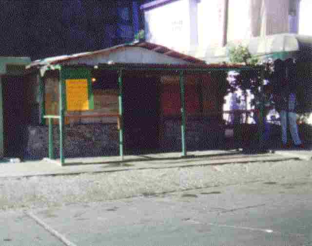 "La Cantina" |  Mural in Topolobampo Square |
|---|
I took the "Camino Libre", free road, out of Lo Mismo, and wound up in Ahome, and 20 miles out on a farm road. Making my way back to the Autopista, losing an hour of travel time. There was a bad truck accident about half-way to Navajoa, just past Estation Don, cab crushed totally. I was about 350 miles from Nogales and the States.
All the way from Mazatlan, the coastal plain is very flat, 20 miles wide, and is intensively cultivated, corn, wheat, vegetables, strawberries, with irrigation canals coming from the mountains to the east. I made it on past Guaymas and on to Hermosillo, where I stopped for a double burger for dinner.. the price of gas and tolls were chewing up my cash fast, daily costs amounting to about $50US per day. Between Hermosillo and Santa Ana I stopped to take pictures of my last sunset in Mexico. By Santa Ana it was full dark. I made Nogales about 8pm, no problem crossing the border, found a Wells Fargo ATM, drew $200 US cash, fueled the tank, and had a cup of AMERICAN coffee, went on to Budget Motel, got a hot shower, my first in a long while and put a tired body down, glad to be home in the States.
 The Last Sunset In Mexico |
|---|
Leaving out in the morning toward Tucson and Phoenix, after checking the weather map in a truck stop I saw that the weather to the north and out on the California coast may keep me in Southern Arizona for a couple of days. The road from Nogales to Tucson made me gratefully appreciate the highway system in the US. I ran straight through Tucson towards Phoenix on I-10, cut off on the US87 north to Coolidge and breakfast, then on to the Casa Grande Ruins. I had stopped in Coolidge at a part store and got oil, a filter, Rainex and Marvel Mystery Oil to mix with the gas. I believe in MMO to keep the upper cylinder and valves in good condition.
Casa Grande Ruins were built of a monolithic stiff pour of caliche mud in about 2 foot lifts instead of block, much as we do concrete buildings today, then stuccoed over after it had dried out.
 Casa Grande Ruins Under Cover | 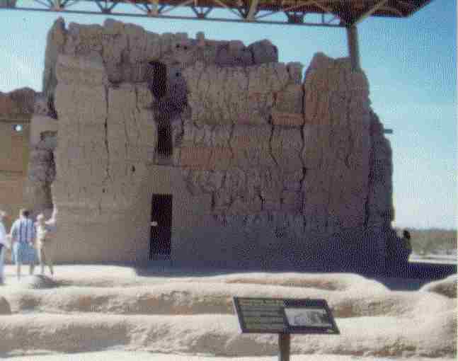 Casa Grande Ruins Closer Up |
|---|
Leaving Casa Grande, I rode through Florence to Apache Junction, bought myself some rations of smoked sausage, apples, bananas, Dinty Moore stew, chili, and got water. I rode out AZ288 toward Roosevelt lake, past Tortilla Flat to the dirt road Apache Trail, up and over and down, really down, into the canyon and made a beautiful camp alongside the wash with canyon walls towering around me. I changed the oil and filter in an old fire pit, and had a good fire all night and in the morning again, without wood, just turning the oil soaked ashes over and over again.
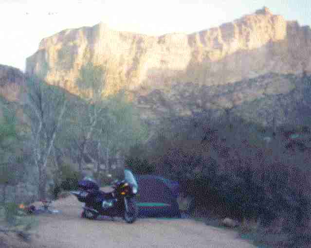 Camp in Apache Canyon Evening Sun on North Wall | 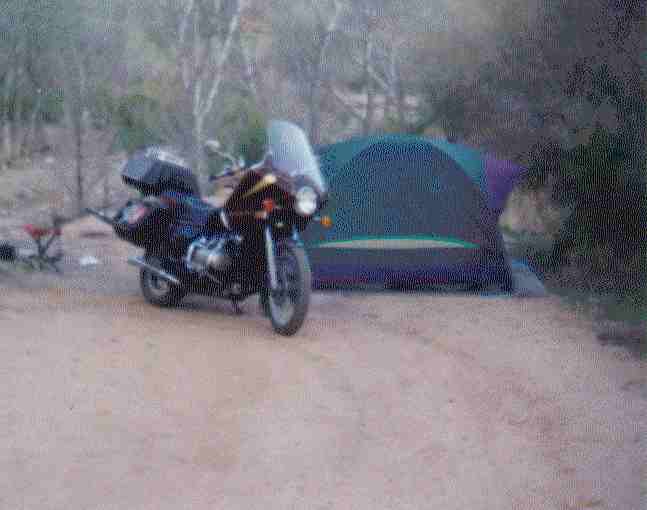 The Old '75 GoldWing in Camp |  Morning Sun - West Wall Treacherous dirt road down just above brush line |
|---|
In the morning the sun made the canyon walls about 7am and the camp about 8am while I fixed and ate breakfast. It was fifteen more miles to Roosevelt Dam, dirt road, 1st and 2nd gears, and brakes all the way. I turned right to Tonto National Monument - Very Interesting cliff dwellings of the Salado people of Hohokam descent - I watched an interesting video at the monument headquarters. Leaving there I drove up to Tonto Natural Bridge, then out toward Phoenix. The fuel filter gave me trouble again so I replaced it with an automotive type at the first NAPA in Mesa.
Arriving in Phoenix, I called my friends DeeDee and Tom. DeeDee was off in Fort Irwin in California playing G.I. Jane in the reserve, but Tom and I and Big John, who is staying with Tom and DeeDee, had a good night swapping yarns. Next day Tom and I went to a meeting in Scottsdale. One member, Gene, rode out with me on the road to Wickenburg, then I rode on alone to Parker, crossed the Colorado and made a beautiful camp in a pile of desert rocks about 55 miles into California on the road to 29 Palms. The pile of rocks were in the shape of a U, facing away from the wind. A nice sandy floor to pitch my tent and an already built fire pit. I made a small fire for the night out of readily available mesquite and dry desert brush, sat and meditated about the trip and all I had seen in my travels, the wonders of the magnificent things mankind has accomplished and can accomplish as The Creator leads Mankind forward on His Path. I went to sleep in gratitude, listening to the coyotes, the desert kangaroo mice, and the owl. Grandfather has been good to me.
The next day I went through Desert Hot Springs, visited with Sam H. for a short visit, and rode into the Friendship Club in time for the noon meeting, hung around talking with old friends until after 9pm, then rode back out to my sister's home in Highland. I stayed with them two days. While there I got a new back tire for the cycle, and put it on. I had over 15,000 on it, unusual wear life considering the roads I have been on. I made contact with my friend Phil the truck driver, to meet up with him at Los Banos near San Francisco, rode out of Southern California up I-5, loaded the bike on the front of his trailerload. I crawled up in the cab, and rode home in warmth and pleasant company, enjoying the ride from the heights of the cab of an 18-wheeler, watching the road pass by in the chill, the rain and the snow, listening to the stereo, the staccato of the diesel, and the swish of the wipers on the windshield. What a way to go!!!
I celebrated the evening of February 28, a very special day for me for the last almost 26 years, in the cab with a cup of coffee from the thermos as we crossed from California to Oregon. We arrived home two days later March 2, 1999, after unloading and reloading in Seattle, and coming across Snoqualmie Pass and the Columbia River to Spokane. A friend, Chuck K., had a fork lift to take the bike off the truck trailer, and I rode the cycle the last 15 miles home to Idaho, to the ranch and into the barn. The trip was over......
I spent the summer of 1999 motorcycling to powwows, campouts and gatherings every weekend, 3 and 4 days of the week, all over the northwest and BC, and relearning to play my banjo, which I had set aside 35 years ago.
Now, today, Oct 22, 1999, I am preparing to leave out again tomorrow to snowbird in the south, exploring more of the deserts and cultures of Southern California, Arizona and New Mexico, and maybe into the Copper Canyon Area of old Mexico, an area 4 times as large as the Grand Canyon of Arizona, and 1400 feet deeper. I missed it on this trip, not seeing it on the map...
Until I return in the spring of the new millennium, with the next saga and the things I have found and seen, you all have a great time in life, grateful for the gift of life that the Creator has given to each of us. There is absolutely NOTHING TO FEAR as we follow His Path.
I leave you with this message, Windwalker Listens
Well, things did not work out the way I had planned. I got down to California, visited again with Trish in Santa Barbara, with Maricela in Santa Paula, stayed with my kids and granddaughter a couple of days in Ventura, spent about 5 days in Orange with old friends, and had dinner with Yamini, visited Rico in Victorville twice.
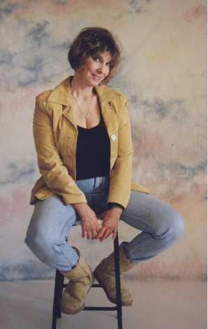 |
(She took her own portrait, and I think there is an Imp in the picture, just waiting to surprise us.)
While in Apple Valley I hurt my back trying to pick up the motorcycle after I dumped it trying to make a U-turn on a sandy hillside, foot slipped in the sand at slower than walking speed and I just let the bike lay over. No problem. The "dumb" was me trying to pick it up by myself. Didn't bother me that day but a couple of days later, it sure did. I was camped at Mesquite Springs in Death Valley about 3 miles from Scotty's Castle, woke in the morning, and couldn't straighten up...could hardly roll over... About that time Higher Power screamed at me and said "Go home and get it fixed." I came back up Highway 395, freezing as I came over the pass at Lee Vining, snow on both sides of the road and hard frost at 8300 feet. I had a little rain between Burns and John Day, and a little again as I came into Spokane, but all in all it was a good run through beautiful country and some wonderful vistas. The chiropractor proceeded to straighten me up and things are going well. When I got home, I found other things which needed my attention, so I was where I was supposed to be.
Now, I am planning on wintering through here, and leaving out again in May to cross the US, visit my sister in Kokomo, and Mike at Padanaram, attend International 2000 in Minneapolis in June and continue on from there up the Canadian side of the Saint Lawrence to the Canadian Maritimes, then back across Canada as far north as I can find paved roads...maybe even to Hudson's Bay.
And that is the way it is.....
"We shall not cease from exploration, and the end of all our exploring will be to arrive where we started and know the place for the first time."- T.S. Eliot
I received this darling in mid April, 1999.
 Hayley-Rose at 9 months... |
|---|
My, but she is a big lady now - July 21, 1999
 Hayley-Rose - First Birthday... |
|---|
Brett, Christine, and Hayley Rose visited here at the ranch during their vacation from Aug 11 thru Aug 14, 1999 when we went over to the old ranch in Montana, and then they returned home. This is Mom with Grandson Brett and Mom's newest G'Granddaughter Hayley
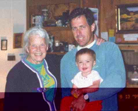 Hayley-Rose - With G'Gma and Daddy... |
|---|
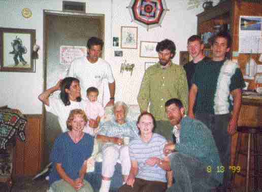 We are Family Back, Christine holding Hayley, Brett, Casey, Tim's Justin and Tony's Justin Front, Bobbi Jo, Mom, Becky Jo and Tim I am behind the camera |
|---|
 Casey, Brett, Myself, and Michael Markcum My Sons and Stepson |
|---|
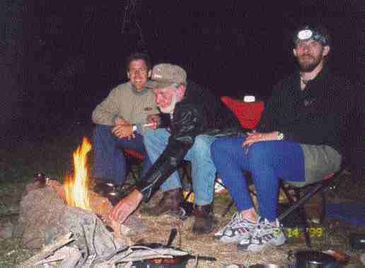 Brett, Myself and Casey Camping together for the first time, Aug 14, 1999 |
|---|
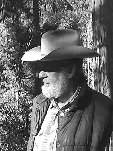
I rode over from Idaho on the cycle. Brett, Christine and Hayley in their car, and Casey leading them from Galen, up Dry Cottonwood to the pass into the ranch. Casey and Brett had to leave early next morning, Casey to get to class at the U of Idaho, and Brett to pickup Christine and Hayley in Butte, to continue on their return home to Ventura and back to work. I went up on top the knoll behind where the old ranch house stood. It is gone now. Filled with gratitude and brimming over with pride in my sons and what they are accomplishing with their lives, I sat atop the knoll at the ranch, my special sacred place, and observed and meditated through the day and following night, before returning home. This is the result, Windwalker Listens.. It is a legacy for them...
I have not written, and probably won't, the travels for 2000 through the north and south of Canada and the Midwest or for 2001 or 2002, as it was basicly just more of the same, another 100,000 miles, back and forth wherever the road ahead led me. I did have to overhaul the old gal at 200,000 miles, she needed some TLC, as her valves and rings had worn out, but the bearings were still in specification. The old gal is up and running, with another 10,000 since overhaul. The Old Gal and I made our last big swing around the country in 2002 to Akron for Founder's Day, the East Coast, Wyoming and the Tetons again, the Grand Canyon country, the whole of the west coast up Highway 1 again, back and forth across the mountains, whereever, visiting back roads we had not yet seen.
Now since November 2002, in 2003, 2004 and 2005, the Old Gal is restiing for a while. I reached the age of 70, my son presented me with an opportunity to change my mode of transportation, and enlarge the scope of my travels and adventuring. See The Voyages of the Windwalker" across the Atlantic and finally getting swamped and sunk in the Mediterranean in a hurricane strength storm.
In 2006, I got her fired up again and have made one trip so far, across the mountains in the rain to Coop's Lee Springs Memorial Day Campoutnear Lolo Hot Springs.. the ride back was mostly dry. I will be riding through the summer to local campout, then in August to Casper, Wyoming to my 55th Highschool Roundup. and then for one last swing around the country to Maine, Florida and back across to California and north and home to Idaho... At 73 I am slowing down ... some....
But --- The Old Gal and I will make more miles together --- !!!
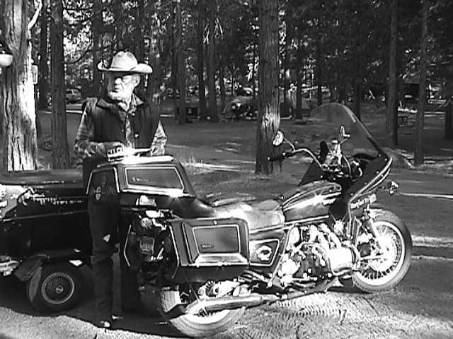
She is an ancient old '75 Goldwing, a real Classy Gal, the first of the Wings!!
Doesn't give me any guff and Dependable Too!! I Love Her!!
We have traveled the Road To Happy Destiny together now for about 200,000 miles!!
And we are going to keep right on going together until we can't go any more!!
There are miles to ride and life to live!!

Love and Peace,
Barefoot Windwalker
Mitakuye oyasin, maka sitomni, hecitu welo!!
We are all related to everything in the world, it is indeed so!!
 |
|---|
 |
|---|