Back And Forth Across The South And Down Into Old Mexico
Excerpts from the Log of "Barefoot" Goldwinging
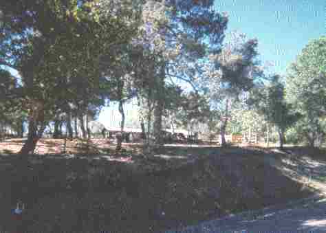
On this portion of my travels, I will not relate so much of the day to day happenings as I did the previous portion around the United States, Canada and Alaska, for, after all is said and done, one day of travel, of camping, of highway is much like all the rest. I will cover the highpoints from the log, those things that reached me down inside where I live. There are so many photos that it will be difficult to select the best to illustrate the magnificence of mankind's accomplishments.
I left the ranch, Oct 10, 1998, ahead of the snow and frost, heading south down US395. By the time I reached Redmond, Oregon the temperature had dropped to below freezing, a light flurry was coming down, so I holed up in a motel for the night, and met with friends of Bill W. for the evening. Next day, riding in slush and drizzle, I passed into California, and on down into good weather. The two day ride the length of California down US 101 terminated in Ventura, where I hoped to find my first born son Brett, whom I had lost contact with 26 years before. I had located his address and phone number via the search engines on the Internet. I did not make a phone call to announce my arrival. As I was a little fearful of rejection, and as I wanted to actually SEE him and how he had grown up, I rode to the address in Ventura which the Net had found.
Arriving at the address, I found a young couple with child standing in the drive, talking with their upstairs neighbor. I got off the cycle, walked up to them, stated "I am looking for Brett Lewis Hardison." Brett turned and said, "Hi Pop, I have been looking for you too, for the last 15 years." I almost melted in my shoes, the long search for the last 25 years was over, and the tears welled.
I had only a picture of him from the age of four, and a vague remembrance from the age of eight, and here was a handsome man in his 30s. Brett introduced his wife Christine, a lovely lady, and .... my granddaughter Hayley Rose, then just 4 months old.... I spent the next two days with them re-establishing a relationship that had lapsed so many years before. Of all the things I have seen and done in my life, this renewal is most significant, and I will introduce Brett, Christine and Hayley right here and now.
I got this picture March 24, 1999 - after I had returned to the ranch from the trip south and into Mexico
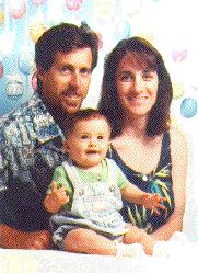 My son Brett, Daughter-in-law Christine, and Granddaughter Hayley-Rose |
|---|
Leaving Brett and family I tried to locate Maricela H., a friend from FIR, was unsuccessful, so I continued on to Orange County, visiting my daughter Susan in Santa Ana, and friends at the Orange Olive Friendship Club in Orange, spent part of a day with my old sponsor Joe Quinn in Capistrano Beach, then continued to San Diego and I-10, that long, long highway across the bottom of the country.
My thoughts as I headed across I-10 were that I would visit MawNan in New Orleans, then continue on to explore Florida down to Key West. At Yuma I stopped to go into Los Algodones to have my teeth checked by a Mexican dentist. The price was excellent, but more than I wanted to do. Back to Yuma, I went to the club there and ran into an old buddy, Darrel, who is now an engineer for the Santa Fe Railroad. His train was on standby for a few hours, so he had wandered into the club too. I had not seen Darrell in 15 years.
From there, it was a long haul, in good weather until I was into the middle of Texas and a Blue Norther came screaming through. The temperature dropped from in the 60s to freezing in less than a mile. I waited it out through the afternoon and night in a truckstop, watching the weather map and TV, dozing in the trucker's lounge.. laid in for about 14 hours.. and then it passed. Back on the road in cooler weather, I continued the long ride across Texas without incident, into Louisiana and to MawNans, staying there a few enjoyable days, visiting friends in New Orleans and vicinity.
MawNan could not ride with me into Florida, so I lit out by myself. Never having been below the panhandle of Florida, I did not know what to expect, other than swamp. The other side of Talahassee I jumped onto US90 so I could go north to Valdosta, GA and visit with my FIR friend Jami, her husband Bob and her kids, Jamison and Melissa. I stayed with them 3 days, having a wonderful time with them and their monster dogs, Great Danes. I took Jamison to a couple of his Little League games, their team winning the pennant unbeaten, and thoroughly enjoyed my visit.
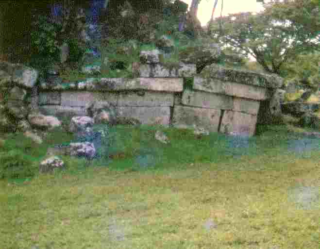
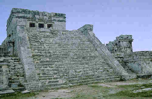
Back south into Florida down I-75, and at Lake City getting on FL-100 pointed toward Saint Augustine, I broke the speedometer cable but found a replacement in Stark. On down to Palatka where I stayed overnight with a FIR buddy, then up to St. Augustine where I visited the Spanish Fort Castillo San Marcos, spending a couple of hours there. I was quite impressed with the workmanship and design of the Spanish engineer, Ignacio Daza. It is the oldest European fort built of stone blocks in the United States. Building of the Castillo began on October 2, 1672, and was mostly complete by 1695. It is made of coquina rock, which is made up of small pieces of shell that have been cemented together. It is particularly good for fortifications as it "swallows" any projectiles that hit it. This link - Exploring the Castillo de San Marcos - is a particularly good online virtual tour.. http://www.harcourtschool.com/activity/castillo/maptour/maptourmain.html
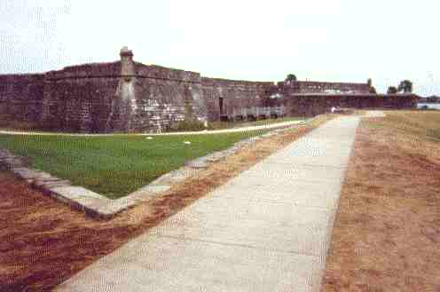 The Walk in to the Sally Port | 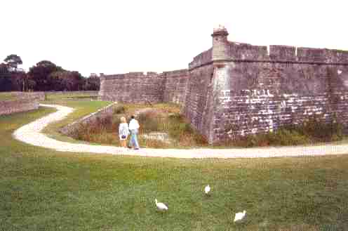 Diamond Shaped Bastion | 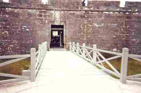 The Sally Port to the Ravelin and Drawbridge |
|---|---|---|
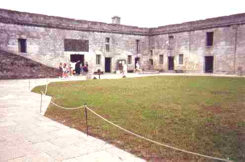 The Central Court and Yard | 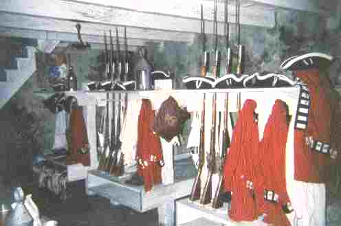 The Guard Quarters | 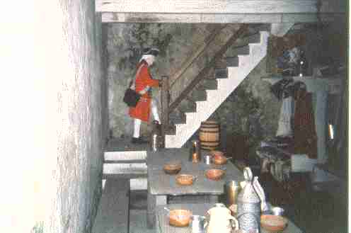 Going On Guard Duty |
Getting back on the road headed south down I-95, I got off the BIG road and visited the Ft Matanzas National Monument in the middle of the coastal shipping lane south of St. Augustine. An interesting small fortification protecting the "back door" to Castillo San Marcos, the National Park Service has a nice free launch ride and guided tour out to, into and around the Monument. It was built in 1742 after the British 27 day siege of St. Augustine by Gen. Oglethorpe in 1740.
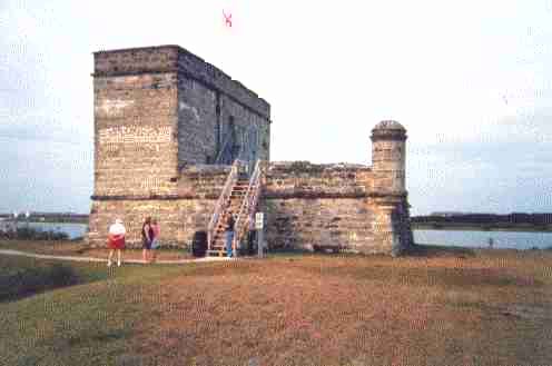 Fort Matanzas National Monument |
|---|
Then down the center of Florida, off the bigroad, a whole lot of flat country, and not exciting at all....just flat....and hot....and muggy....and buggy....in November and December....and people come here to vacation???? I have lost or misplaced my notes of this part of my travels so I will wing it from memory and photos...It is probably just as well....
I jogged out to the coast to Cape Kennedy and took the guided tour. Quite impressive and worth the dollars, to see the progress and equipment made since I worked in aerospace 30 years ago. Not something I would do again, but once ok... I saw a few alligators in the drainage canals in the complex. You can go on a good Virtual Tour of Kennedy Space Center at http://www.ksc.nasa.gov/ksc.html
Back inland to Kissammee, and down around Lake Okeechobee coming into the backside of the Miami area where I met with my friend Bruce J. in Miramar, staying with him and his wife Barbara for a couple of days, going with him to the hospital where he works with people seeking recovery from drugs and alcohol. Then on down the Keys to Key West.
 Bruce and I |  Happy FIR Friends |
|---|---|
 Barbara Thinks Anonymity Is Best |  Bruce and His Much Better Half, Barbara |
I traveled along "sedate and dignified", stopping in Key Largo for a meeting, arriving in Key West late, about 10:30. It was a nice night. Sat in an all night outdoor cafe, cross corner from Sloppy Joe's Bar, drinking coffee, and observing the night life of the night people, talked with a pretty young girl, who works the streets, for about a half hour, when she came by for coffee. Her trade was slow that night. I toured Duval Street and a block each side on foot. About 2:00am I got on the bike and went out of town about 5 miles where I found a dry flat spot to camp in, off the highway about a hundred yards in the edge of the mangrove swamp.
It was a hot, muggy night, mosquitoes, etc. but I slept well. With morning I went back to Key West, got some photos taken of me at the marker of the Southernmost limit of the US, another in front of Barefoot Bob's Bar in the tourist area, caught a noon meeting at the southernmost AA club in the US. That done, I decided I had seen all I wanted to see and done all I wanted to do in Key West, and started back to Mainland Florida.
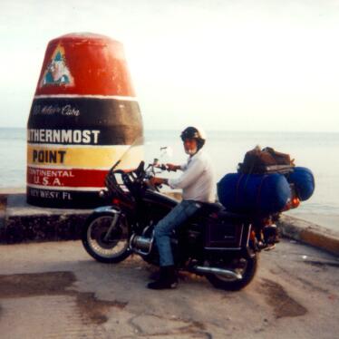 Farthest South On A Motorcycle | 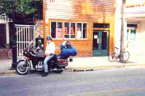 Barefoot Bob's Bar | 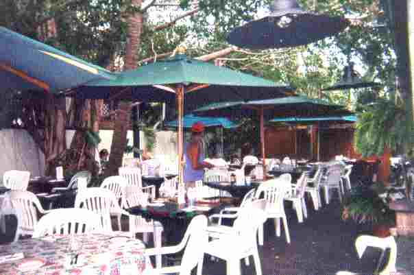 Barefoot Bob's Bar patio |
|---|
For a long time on the Net there were only two Barefoot Bobs listed, one, the owner of the bar shown, and myself, and I damn sure am not a bar owner. He has since sold it, refusing to deal with the IRS, and in that we are alike.
Back on the mainland, I went out through the Everglades and the Big Cypress on the Tamiami Trail, cutting up through the Seminole Reservation where I camped and spent the day talking with tribal members. I finally made the west coast of Florida at Fort Myers, and rode out of Florida on US41 and US19. Riding in a light ground fog at dusk, just before Homosassee Springs, a big boar razorback hog jumped out in front of me across the road. I missed him by about a foot and a half ...way too close... and I stopped in Crystal River, the next town, got a cheap motel room and shut it down for the night ... that boar was just too damn close. A fellow could get killed that way riding at night. It would totally wipe out a motorcycle. I have seen what one does to the front end of a car, and I want none of it.
Glad to get out of Florida (I have been there, done that, and don't ever have to do that again) and back to New Orleans without further incident, I stayed at MawNan's for a little better than a week, put new tires on the cycle, tuned and changed oil, general maintenance, etc. preparing for the ride into Mexico. We caught meetings with Brian, a relative newcomer, in Clinton, and one with Cajun Harry in Houma, and others in Gretna.
I visited with Gus in Donaldsonville for an afternoon, got back on the bigroad to Houston, got rained out going into League City, where I visited for three days with Cindy J., a FIR friend, sleeping on her floor, and waited for the rain to stop. We had a good time in good company and caught some meetings together. I then rode down to Brownsville to visit my friend Hank G. again. After surveying the state of my funds and the cost of insurance, I decided to wait until my next check arrived. So to pass the time I took a series of roads back north and west that I had never previously ridden, through Uvalde, then west to Del Rio and north again to Fort Stockton and White's City, New Mexico.
Arriving late at the Carlsbad Caverns junction at White's City, I rode on in to Carlsbad and caught a meeting, then camped off on a side road. Next morning I was at Carlsbad Cavern at opening time. I walked down the opening and spent about 10 hours in the cavern, covering everything that was open, and a couple side caverns that weren't. I had my maglight with me, so I could see in places that weren't lit. All the photos that I took, most of 2 rolls, did not turn out like I hoped. The flash on the 110 Kodak just did not do the job. It is a good thing that the Cavern has an elevator from the lower levels back to the surface, a lift of about 800 feet. I don't think I could have walked out up the shaft of the natural opening. Take a Virtual Tour of the Carlsbad Caverns National Park http://www.nps.gov/cave/images/images.htm .
When I emerged from the Cavern, it was nigh on to dusk, so I rode out to White's City Junction, turned south about 5 miles, took a right, rode off the highway about 2 miles, turned right onto what looked like a sidewalk, rode it about 200 yards, stopped and pitched the tent on the sidewalk in the dark. I figured I had made a dry camp, but no sweat, I had half a gallon of water for coffee in the morning. I crawled into the sack and died.
In the morning I found that I had pitched camp alongside a small lake that I could not see in the pitch-black moonless night, about 30 feet from the shoreline. The sidewalk was a "Bird Watchers" path around this small lake. I got coffee water out of the lake, heated enough to take a spit-bath, and washed some clothes. They were dry in an hour after the sun came up with a nice breeze.
Back on the road through El Paso and Las Cruces, I headed toward Silver City and the Gila Cave Dwellings, from 65 degrees over a pass with snow on both sides of the road and back down to the Gila River and the Dwellings. There were lots of places to camp. I was the only one there until about 8pm, when a young couple arrived. I walked up to welcome them, noticed they had an Easy Does It on the bumper, and invited them down to my campfire for coffee. We sat and talked and shared and ate and drank coffee until about midnight. Nice young college couple out touring the west, taking off for a semester.
I walked up to the cave dwellings in the morning, wandered around the hillsides all day, back to camp and another wonderful evening. The beauty and ease and security with which the Indians had lived here in peace was a far cry from that of modern civilization. About 40 to 60 people made this their home. The caves are located about 75 yards above a year round creek, excellent water, the bench on the far side a place for planting corn, the river benches a 1/2 mile below providing a lot of arable ground for corn, beans, melons, squash, gourds, cotton and other vegetable crops. A late summer feast would have been grilled trout, venison, wild turkey, corn, squash, wild greens, chokecherries and prickly pear apples. Firewood was plentiful, and the sun warmed the interior of the Caves in winter to about 65 degrees, and later in the summer, with the sun higher, the caves stayed a comfortable 72 or thereabouts. In one of the rooms was a corncrib with over 800 ears of 7 or 8-row primitive corn, still there after seven hundred years. Game was plentiful, I saw quail, rabbits and deer in the bottom land along the river. I would not mind spending my life there and in the surrounds. Yes, the Gila Cliff Dwellings-- http://www.darkisle.com/newmexico/gila/gila.html - would be a nice place to live.
This link to The Anasazi, Olmec & Toltec is an excellent database of links to the early Americans of the Southwest and Mexico down to the istmus of Tehuantepec and the country of the Maya.
I rode out of the monument early via an easier route through Mimbres, where I stopped and had a good breakfast, then back through Silver City and north on into Arizona via Show Low, the Fort Apache Reservation and Globe, Apache Junction, through Pheonix like it wasn't there, and on to the vicinity of Tonapah Hot Springs where I made a good camp in the desert, a few hundred yards north of I-10, behind a pile of highway construction materials.
Morning was cold, I broke camp and went a mile or so more to Tonapah, into the truckstop, refueled the cycle, had coffee and breakfast, and waited for the sun to take the chill out of the air before going on towards California. It warmed into the low 60s, and I rode straight on to Orange and the Friendship Club, making camp in the parking lot after the meetings were over.
For the next week I camped in various places around Orange and Ventura County, missing Susan and John in Santa Ana, they having gone somewhere. I stayed close to the Club until the check hit the bank, then I rode south to Mexicali and into Mexico via Julian, CA and the Anza Borego Desert, across Mexico Hwy 2 to Sonoyta, where I turned north into the States, camping and exploring in the Organ Pipe Cactus National Monument. The first night there the wind came up, I could not get the tent to stay anywhere close to the ground in the open asphalted camp spots, so I moved the tent in close behind the restroom and shower building out of the wind. The ranger objected until I explained the circumstances.
Riding up through the Tohono O'odham (Papago) Reservation and east to Kitt Peak Solar Observatory on the reservation, where I spent a day observing and exploring. The Peak rises sharply from the valley floor and has a nice picnic and campground near the summit. The Tohono O'odham are considered to be the descendants of the ancient Hohokam ("the vanished ones") of the arid Southwest. They were and are village farmers, hunter-gatherers, and peaceful artists sharing the drainages of the Salt and Gila Rivers.
From Kitt Peak I continued on to the outskirts of Tucson catching I-10 for a short distance, then down AZ83 to Sonoita, and east on AZ82 to Tombstone, the "Town Too Tough To Die". It is a town to spend a week in, but I only spent a day. Be sure to visit Boot Hill. It was a roaring mining town, and is now a very interesting tourist town in the southern Arizona desert, presenting "life as it was" in the days of Wyatt, Morgan and Virgil Earp, Doc Holliday, the Clantons and McLowerys and the Shootout at the OK Corral, during its heyday years from 1879 until the turn of the century.
South to Bisbee, another mining town just down the road from Tombstone. It is the 'turn-of-the-century' mining town. Nestled in the foothills of the Mule Mountains at an elevation of 5400 feet, Bisbee once was known as 'Queen of the Copper Camps', a tough mining town. The workings included the Old Queen Mine and the 340 acre Lavender Pit Mine, both now inactive, but open for tours. If it weren't for history buffs, tourists and snowbirders, I doubt that any of the southern Arizona towns would survive.
I went back into Mexico at Agua Prieta, continuing across Mex2 and the seemingly endless flat of the Sonoran Desert to Janos and up to Cuidad Juarez and El Paso, rejoining I-10 for a quick trip to New Orleans to see if MawNan could make the trip into Mexico with me...she couldn't. So leaving out, back on I-10 to Houston, south and west via US59 to Mexico. It was a long hot dry ride from New Orleans to Laredo, camping 2 nights, and spending a day and night getting the necessary permits in Laredo and Nuevo Laredo. When I passed through Victoria, where I met up with a young man, Kris Bilbo, who was a spitting image of my son Casey at his age. Into Mexico, I rode the "free road" to Monterey, mile after mile of nothing but occasional clusters of huts and narrow 2 lane road, trucks and buses in both directions going like a bat out of hell, 20mph faster than I was willing to go. The highway pavement was sometimes good, but mostly unrolled chipseal, worse than the worst in Spokane or North Idaho, patched with a wheelbarrow and shovel.
I camped the first night about 40 miles south of Saltillo, having blown right through Monterey. Saltillo is a clean prosperous town with Chrysler and GM plants, high and dry, about 8000 feet. It was down to freezing by morning. I made coffee and was rolling by 8am across the high desert and on through Zacatecas. About 30 miles beyond Zacatecas are the Quemada ruins. I spent half the day climbing around, up and over the ruins of Quemada built by the Aztecs. Free standing rock walls and fences extending for miles, stone pavements dating from 200-800AD, 170 miles of roads radiating out from Quemada to over 200 villages and estanciones spread over a nice valley. A truly impressive ruins. It was all plastered with adobe in ancient times, of which a little remains. I was much impressed with the rock and earth filled dam they had built to provide their irrigation water, a quarter mile long and appearing to be 30 or 40 feet high from where I was on the top of the pyramid a thousand feet above it.
 Quemada from Parking Area | 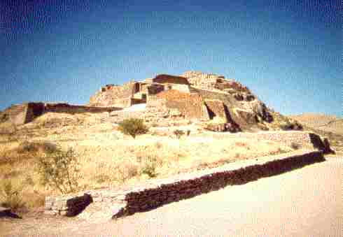 Quemada - Halfway Up | 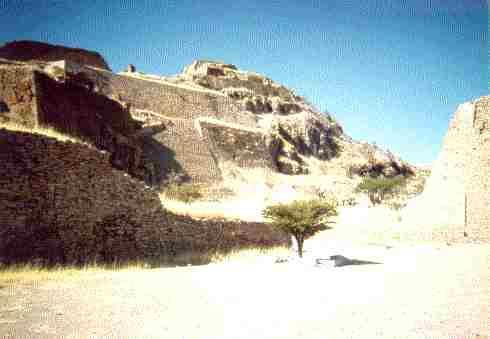 Quemada - Almost There |
|---|---|---|
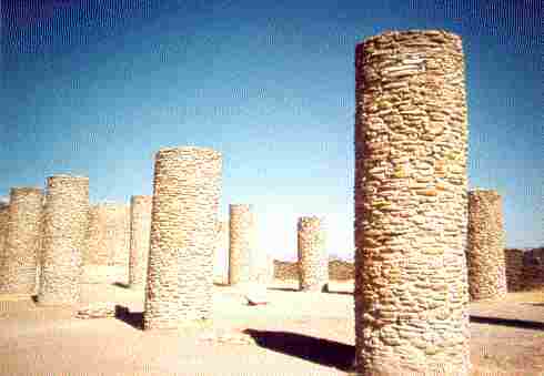 The Hall of Pillars | 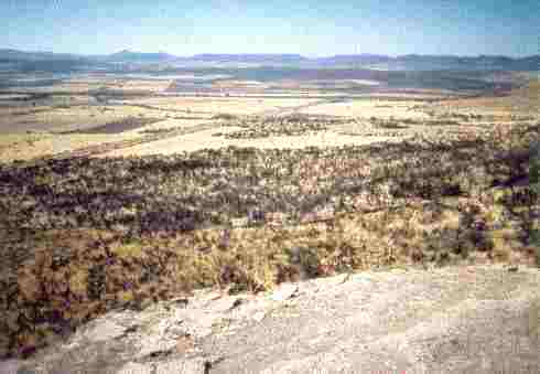 Across the valley from the top | 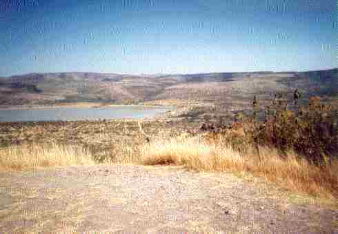 The Face of the Aztec dam |
South from there to Chappala and a lake which appears to be larger than the Flathead Lake of Montana, a nice clean resort town with Anglos.....From Chapalla to Colima I rode through beautiful country on the ocean side of the mountains, bougainvillea out of this world with color, red, yellow, white, long needle (12") pine and madera, down through beautiful canyons and rivers, up and over again, and down, winding, winding, winding. Valleys full of flowering sugarcane 15 ft. tall for mile after mile in the area of Tamazula.
Topping over between Tamazula and Colima, two volcanoes about 12000ft, Nevado de Colima on the north and Volcano de Colima on the south, which belched and erupted a plume of dust and smoke while I watched. I saw it from 3 different aspects in the next two hours as I rode along and saw it belch 3 times.
Food -- the price is right - a full meal of Carne Asada is $25p ($2.50US), a slab of steak, rice, beans, fruits, roast garbanzos, peanuts, salad, tortillas, the works, and a big 1/2 liter of Coke is $5p
All along the way people have been friendly and very helpful, no problema, Senor, very gracious. By this time I was picking up a little Spanish, and getting along OK with "Spanglish". I wrote back to my buddy Phil at the ranch that $650 a month here would provide a real good living. $250 provides a nice bungalow with maid, $150 for food and necessities, and that leaves $200 a month to squander, -- and that the girls and ladies here are as well kept, stylish, beautiful as he could want --- and I am told it gets better the further south I go.???? I found some postcards of the area to mail home, and noted the temperatures, balmy 80s days, and 60s nights most of the year round, a little hotter in the summer, about like Idaho during the summer. Stopping to think about it, this area is one of the most "Civil" places I have been south of Canada and that says a lot.
Leaving Colima I did not find the La Campana Ruins which I wanted to explore. I was on 4 lane south to Tecoman, must have missed the turnoff. The highway was lined both sides for miles with melon stands, all varieties. I climbed through a pass, like coastal California near Santa Barbara with coastal plains like Ventura, miles of coconut palm with 25-50 nuts each, with avocado and orange trees growing underneath and between. Got to Tecoman, took a wrong turn, wound up at the beach. Miles of beautiful black sand beach. I had dinner and the evening in a thatched open resort restaurant, a marvelous meal of Marlin Fillet with all the goodies, and first class service, music and entertainment, $70p ($7US). A very beautiful girl was sitting with her family across from me, enjoying the nice breeze coming in from the ocean.
Returning to Tecoman in the morning I found the right road that headed south. The next 20 miles were banana, coconut, orange, guava, etc. plantations to Playa Alima. I couldn't help but notice the girls here are statuesque and beautiful. I don't know what tribe they derive from but they are tall and slender.
From Alima for the next 150 miles or more the coastal road is much like the Big Sur of California, spectacular vistas of beach and mountain down to the sea. The trees in flower and fruiting, if you know what to pick lunch is free. I stopped on one point on a winding uphill stretch where I could hear a thundering waterfall, but from the lay of the land it can't be a very large creek. I picked and sampled a wild fruit. I have no idea what it was...not very tasty, or with much flesh, but it would do for nourishment in a pinch.
Continuing on toward Lazaro Cardenas about 25 miles, I had a great Carne Asada meal and made camp in a roadside quarry about 5 miles later, about 8:30pm. I was up before dawn and into Lazaro Cardenas for breakfast. The road to Zihuatenejo was almost impossibly bad for the next 50 miles, travelling at 25 mph tops... For the most part the landscape is desert brush/cut and slash farming, occasionally a very well kept/grown estancia plantation of coconut/banana/avocado/mango etc..
Stopping along the road about 50 miles out of Lazaro Cardenas to roll a cigarette and relax for a bit, one thing of note - the Ubiquitous "Bug" is alive and well in Mexico, Vans, Bugs, Things, VW pickups - they are everywhere, 70% of the rolling stock of Mexico.
Sheeesh-La Differencia!!!--- Coming from the last vibrating miles and palm thatched stick shacks into the outskirts Zihuatenejo, from BAD road to 4 lane landscaped perfect roadway, from pigs and burros and kids and dogs in the road to "California Resort" - As modern as it gets. But it is not my kind of area. Out of the Resort area on in to Zihuatenejo, a typical Mexican town and out the other side to a Pemex station about 10 klicks out - Gas, Snickers, Pop and SHADE for an hour. About another 10 klicks down the road Higher Power started speaking to me, "Change Oil". I bought 3 quarts of Quaker State 20-50, $75p, $2.50US per quart. I changed the oil alongside the road about 4 klicks later. It was time.
On down the coast on road high above the ocean, I stopped at El Mirador open thatched restaurant atop a point between magnificent beaches stretching for miles, breathtaking and cool. I ordered a Red Snapper meal. The fish was a 3 pounder served broiled over mesquite, whole, head guts feathers dressing and all, but with the hide diced for the spices to penetrate, I don't know what kind but excellent, with fresh lime, hand patted maize tortillas, tomatilla, onion and cabbage salad, picantes, a very excellent meal which kept me on through the day until night.
 The beach to the south |  El Mirador Restaurant |  The beach to the north |
|---|
I arrived in Acapulco just at dusk after stopping for gas and to rest my butt for an hour, about 10 or 15 klicks out. Coming into Acapulco was a madhouse until I reached the beach area, a wide 4 and 6 lane boulevard, busy but negotiable. The bay and beach are beautiful. I found a bank and drew $2000p as I was running low on Mexican currency, having spent most of the $2000p I drew in Nuevo Laredo the week before. Right where I had parked the motorcycle on the main drag was an excellent restaurant, Restaurante El Mayab, with better than good coffee, chicken taco dinner less than $50p. Everywhere I have been I have found the Mexican people very gracious and helpful, including the Federales.
A lot of Anglos, French and Canadian folks were wandering by, mixed with a lot of Hispanic on vacation, busy, exciting place. Watching the lady, who was out on the sidewalk inviting people in was a kick, a very pleasant, attractive woman of about 45 years. (My nose was running and my head sweating from eating too much salsa and jalapenos.) She was out there bouncing to the Mariachi music playing on the speaker system. This is a fun town as has been reported.
At the table next to me was a group of Mexican folks having a great time celebrating a birthday, talking and gabbing at a high rate of speed. My waiter was Tomas, a young man about 26, highly personable, efficient and attentive. He spoke English very well, a good asset to the restaurant.
I walked about a mile down the strip and back. The vast majority are Mexicans on vacation or locals. No where was I hustled. The traffic picked up about 8:30pm. The temperature was still about 80, and the humidity was high, so I returned to the bike, and waited and watched. Horse drawn shays with balloons streaming went by about every minute, buses constantly and VW taxis everywhere. The traffic slowed down about 9:15 after I had a chat with a young Canadian chap. I traveled south out to the airport and back looking for a motel, found one a block back from the main drag in from the Hyatt Resort Hotel, that cost me $180p, not 1st class but good, slept well after I washed and dried a couple of shirts.
Returning to El Mayab for breakfast the same Mexican woman was greeting folks, same pleasant demeanor, gracious, she must be the manager. I had a continental breakfast, fresh squeezed orange juice, 4 slices of toast and more strawberry preserves in a bowl than I could use, $20p. I studied my map, and decided to go on down the coast about a 100 miles, then head inland on Hwy 125 toward Oaxaca. While sitting there I scratched my nose...sun baked crisp and bleeding..Damn!!
It was a beautiful Sunday morning, traffic relatively slow, balmy, but I could feel the humidity and temperature rising, 9:30 and time to get moving. On the way out of town, I had to laugh,-- American women out STRIDING back and forth - some things never change, on vacation or not - EZ DUZ IT, - Despacio!!, Disminuya!!
One thing of note.. south of Lazarro Cardenas definitely a different genetic stock, mixing to a shorter, stockier, coarser featured people.
South of Acapulco Hwy 200 is as well engineered, graded, laid and rolled as any in the states, except the shoulder dropoff is abrupt, in places as much as 12 inches, as many as 6 lifts of asphalt. Apparently they do not have the equipment to remove and recycle the asphalt as we do in the States. About 60 klicks out of Acapulco I went through a short stretch being redone, good chipseal, then excellent again, with lots of wild burros feeding alongside the road.
I turned north on Hwy 125, a fair to middling chipseal road, but winding, 35mph max., mostly 25mph. I made 45 miles in to a clean dirt floor palapa restaurant and had a good meal of Bisteque Ensebollado??? The sun was intense all day and my butt was fried. It was very pleasant here in the shade, a puma hide decorates the wall of the cocina, the kitchen. I am beginning to understand the Mexican concept of siesta and manana. These are a very artistic people, living good and living slow. A truck alongside is decorated with flowers, snapdragons and lilies. Dinner was good, but they kill a steak.
About 15 miles on I filled the coffee pot and water jug from a spring cascading to the road, and at about 68 miles in from the coast highway, I made an excellent camp atop a knoll at a switchback in the road. Made a fire, coffee, washed up and turned in at about 8pm in bright moonlight.
A convoy of Federales on their way to their posts woke me as their trucks and vehicles ground their way up below me. I waved to them as they went by and got a bunch of waves in return, youngsters doing their military duty. Traffic was picking up, one or two vehicles ever 5 to 10 minutes. A beautiful morning with light breeze. I topped over the pass in about a 1/2 mile, looking into a deep valley full of morning fog. The road for the next 20 miles was no place to be in a hurry, winding and broke up, washed out in places. The nice small town of Putla de Guerro was next, with fairly substantial structures, nicely painted in pastels, semi-tropical fields of corn and cane. The cane cutters were at work, the cane coming out of the field on the backs of burros, 200 pound loads I would guess.
While stopped to rest, I could hear a rooster crowing in the distance, the sun was warm and felt good. I had been on the shade side of the mountain for 10 miles. The sky was absolutely clear. A peon came by and we talked for a few minutes. He had worked in Idaho, the Boise area, about 2 years ago, and spoke good English. He told me I was about 5 hours out of Oaxaca.
Farther along girls along the roadside in distinctive, costume, dark red poncho type dresses, with beautiful embroidered geometric patterns. I would wave at them as I passed, but none ever waved back. I was told later that if their men had seen them waving at another man, they would be in trouble. A little farther I stopped at a roadside shrine and small cascading stream to fill my water bottles. This whole stretch of road was a vista of luxurious cliffs, and dangerous curves, the road hanging on the side of the mountain, corn fields in impossible locations, cut and slash, on mountainside so steep it should be against the law for even mountain goats to walk there.
At the top of another pass not far on, I stopped to drink some water and one of the most memorable occurrences with the people. I was watching a fellow come up the road with a load of firewood on his back and twice that amount on the burro being led behind him. He set his load down, we talked for a couple of minutes, I should say communicated haltingly. I pulled a dry tortilla left over from the night before from my pocket and crunched it. Jorge said, "Un momento, senor", shouldered his load, started the burro and headed up the side of the road. In just about 5 minutes he came back with a thick foot diameter corn tortilla ladled with black beans and handed it to me. Jorge would take nothing for it, not for his esposa, nor for his ninos. He said, "No senor, mi casa es su casa." I almost broke out in tears with his graciousness and concern for me. We talked a while longer, then we both had to go our ways.
I reached Tlaxiaco needing gas at noon. On the map it looks like maybe 50-60 miles from the coast and it is nearly three times that far. On a ways was a Dominican convent under reconstruction, San Jose Tepesculola, where I stopped and took a couple of pictures. A typical old Spanish mission and church. The interior was still beautiful.
 Jorge's Home | 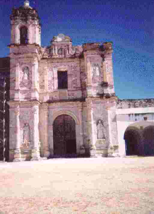 San Jose Tepesculola | 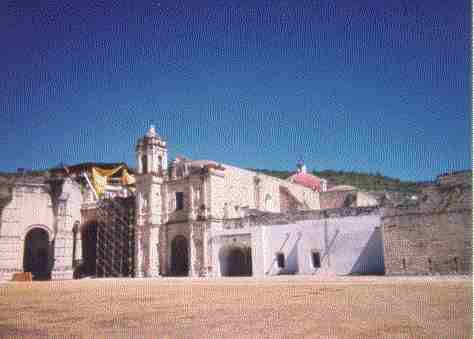 San Jose Tepesculola |
|---|
Stopping for lunch at the junction of 125 and hwy180, I determined I was about 70 miles out of Oaxaca, figuring I could make it by nightfall if the road was like it had been, or in a couple of hours if the road was good. Ten miles from the junction, the road became an excellent 2 lane "Rapido" that cut the distance to 35 miles. It was almost spooky to be travelling at 65-70 after days of 20-45mph. I put a note in my log at this point.. Note: Most of Mexico that I have traveled through so far is Semi-Desert or Desert, not tropical as I expected....
I arrived in Oaxaca about 3:30p, driving in direct to the Zocalo, the city square in the heart of town, facing direct on the old Spanish cathedral. I parked and walked around until I found an expatriate, Scotty, a Nam paraplegic, who lives there. Scotty was helpful giving me the lay of the land. At dusk I located the Hotel Posada, and signed in for 3 nights, showered, shaved and clean clothes. Scotty said the year round temperature was 75 days, 57 nights plus or minus 3 degrees.. Dinner was $20p, a carton of cigs was $60p ($6 US)
I stayed on the Zocalo from 7 until about 11pm, listening to music, talking with people form Holland, New Zealand and Belgium, exploring the cathedral, a museum that was open, got directions to the Monte Alban ruins and had my boots polished for a buck. By 11 the day had worn me out.
In the morning I found the location of the meeting place, 1 block from my hotel, found a laundromat and put my dirties in, then went out to Monte Alban ruins. It was quite impressive. Amazingly the cement is still in place, a combination of adobe and lime cement. The pyramids all have tunnel stair wells to the top. The sides of the pyramids were plastered with the same adobe/lime mortar with some remaining. While exploring the ruins, I met people from Canada, and we went to the onsite cafe, to get out of the sun and talk. After seeing all I wanted I returned to the Zocalo, wandered around town, met Scotty twice, got lost cycling around, went to an AA meeting, didn't understand one word out of twenty, but understood they were just as damn glad to be there as I was, alive and sober. I then returned to the hotel, studied my Spanish tutor books and slept well.
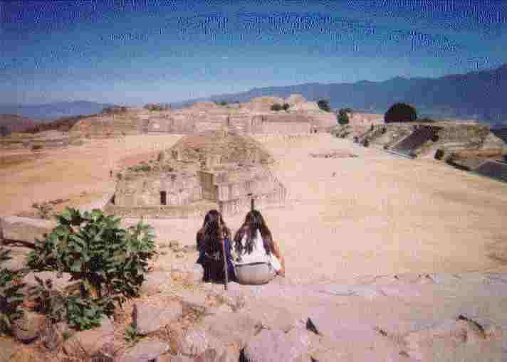 Monte Alban | 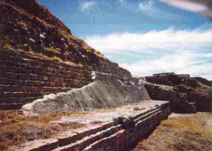 Monte Alban Pyramid | 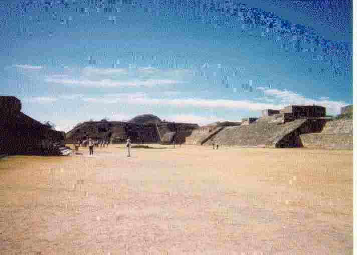 Monte Alban Plaza |
|---|
I spent most of the morning studying my Spanish and accounting of funds, I could see that I would have to be more frugal, determined that I could do well on about $300p per day, the biggest expense again was gas. In Mexico you have one choice, Pemex, the national cartel, and the price is high compared to the States. The rest of the day was mostly relaxing around town, the museums and churches are wonderful, dating to the 15 and 1600s. It would take a month or more in Oaxaca to see them all. I spoke in Spanish at the meeting, nervous as hell, but I put together about 2 minutes and had fun.. I took pictures of the group and meeting place. I then walked up to the Zocalo and listened to music for awhile, meeting an expatriate artist, Indigo, who was doing better down here painting for tourists than he was in the states.
I packed up in the morning, and prepared to leave town, not anxious to leave at all, the town is so friendly, safe, and beautiful. It amazed me, I could leave the bike parked for hours and nothing was ever touched. I could have left the keys in it. A premier town in which to retire, although I did not make contact with the retirement community there.
 Near Oaxaca | 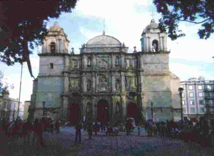 The Cathedral across the Zocalo | 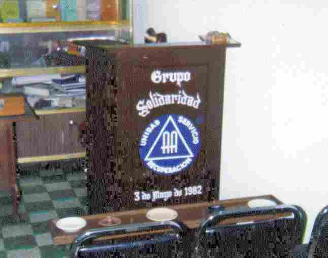 El Grupo Solidaridad, Oaxaca |
|---|
On the way back to the coast, Puerto Angel, Zipolite and San Augostino, about 20 miles out of Oaxaca, I came to the pretty town of Ocutlan, and about every 10 klicks nice little hamlets built around an old Spanish church. Between Ejutla and Miahuatlan I saw burros carrying impossible loads of cane and corn stalks, farmers plowing with oxen and wooden plows, two wheel traditional oxcarts piled high with farm produce. The road was pot-holed most of the way to Miahuatlan, but some stretches were good. I stopped in Miahuatlan for lunch, had Tostada de Pulpo??? I think it was octopus, tasty and excellent sauce like a hot russian dressing. I looked at my map which showed Miahuatlan about halfway to the coast and Puerto Angel, I am only 60 miles out of Oaxaca, and the distance from Oaxaca to Angel is 150 miles... a lot of mountain road ahead of me.
My face, nose, lips are crisp. I spread 1st Aid cream on hoping it would help, that and the new hat I bought in Oaxaca - the sun is INTENSE here - but the air temperature is very pleasant. In the foothills out of Miahuatlan, I saw a couple of 2 man primitive sawmills, one man up and one in the pit under the log, working a hand saw up and down, getting every last board out of the madera logs. Also high wheel oxcarts bringing the logs in, big oxen with huge horns.
In the middle of the afternoon I stopped to rest. The road had been real bad, washed out and caved in, forded 3 streams, windy, and 20-25 mph, up and down through fairly lush pine forest. The temperature was 70 with a mild breeze in the forests. I noticed a remarkable fact, in all of Mexico so far there has been a total absence of insect pests.
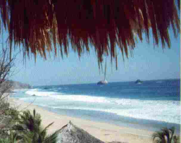
Puerto Angel - I must have come down 8000 feet, it is hot but a nice ocean breeze...I went through Angel, and on to Zipolite, looking for a motel, got to San Augostino, stopped where I saw cabanas for rent, and an American RV from Ohio. Barney and Dave are corn farmers from Ohio who have been wintering here for the past 20 years. My cabana was up about 50 steep steps above the road level onto a point of rocks, where it caught every breeze. It was basically a palm thatched palapa with the sides matted with woven corn or cane stalks, through which the breeze blew, very comfortable, and the bed was good, as was the hammock which was outside under the roof. The cabana was $30p per day.
The local fishermen had made an exceptional haul of bluefin tuna, so the community ate a lot of tuna fillets that week. A fabulous dinner of fillet, as big as a meat platter and an inch thick, with all the goodies and picantes and fruit was $25p which included 3 coffees and two 1/2 liter bottles of Manzana, a carbonated apple juice soda. I sat and talked with Barney and Dave until after 10pm.
I woke early and watched the sun come up, made coffee and rolled cigarettes. I noticed that the rear tire of Dave's scooter was flat, so I used my compressor to pump it up. Nobody else stirred until about 8, then slowly came alive. We went to the restaurante and had a big breakfast about 9:30 - juevos estrella, cocina, papas, tortillas, y jugo naranja - Eggs sunny side up, bacon, fried spuds, orange juice tortillas and coffee - all for $23p. I had to go to Puerto Angel to get my money broke down to $20 peso notes, nobody in San Augostino could break a $50 peso note. It took over 30 minutes in the bank, waiting in line, returning to San Augostino about noon. I stopped at the nude beach in Zipolite on the way back to check it out...just people walking around and laying in the sand or in the surf with no clothes on... If I did that it would fry me to a crisp.
On my return to San Augostino, I attempted to practice siesta and manana. It is a very hard thing to do, doing nothing, but I am beginning to get the hang of it. The most difficult part of it is the fact that when you are doing nothing, you never know when you have finished the job.
While laying in the hammock I took some panoramic shots of the beach and area, panning from the west to east as the beach lays. I finally fell asleep and slept until the sun came below the edge of the palapa. I went down to the beach to watch a girl chasing a hermit crab up the beach. It was about 2 inches, and very quick. I caught it, about 3/4 inch across the back, set it down and chased it back to a hole closer to the water. She is a teacher, down here building herself a home on the point down the beach. I don't know how she has obtained the ground, but she had local labor do the adobe walls and the heavy beam work, the palm thatching, and interior plastering, she doing the interior finish work, moldings, tiles, cabinets, plumbing and wiring, etc. It is a 700 square foot bungalow on a 1/4 hectare. I asked how much she would have in it when done. She said that it would be about $6500 US including all the accessories, appliances and furniture when complete.
I walked out to the lost fishermen's shrine on the point of rocks across the sandspit. It was pretty beat up by storm waves, but had a fresh bouquet of stocks and candles lit. The rocks are hematite with rose quartz interlayed, standing on edge. I watched a group of kids playing soccer on the wet sandspit for about a half hour, the two older ones were real good. Back to the palapa, sat around talking and doing nothing, walked on the beach in the moonlight, went down beach to La Puesta watering hole and dance hall about 11pm, it was dead.
Next day was pretty much a repeat, watched the waves and whales, rode the back road to Pachutla and back around through Puerto Angel to San Augostino, read newspaper and did nothing. Planned my route for when I left out the coming Monday. Had tuna fillet. Had a little trouble in the camp - a drunk drug dealer - but I ran him off with no little furor....it all settled out.
 From My Hamaca At Siesta Time | 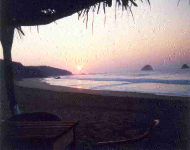 In The Quiet of the Morning At The Awakening Of The New Day |
|---|---|
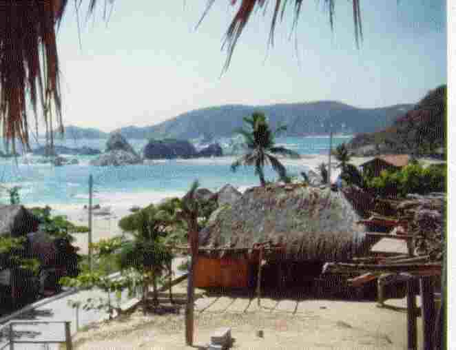 View from My Palapa The Bay and Restaurante | 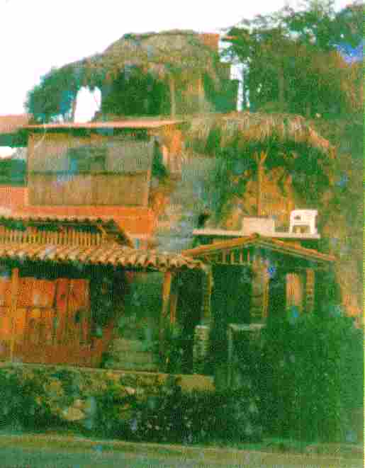 My Palapa Cabana On Top of the World |
A beautiful morning Monday, quiet, a nice day to ride. Left out about 9am. Filled with gas in Huatucla. The road out of Huatucla was pretty bad in places, but the last 50 miles into Salina Cruz was excellent, running along beautiful bays and beaches. Just out of Salina Cruz the wind came up from every direction, almost blowing me off the road. Making Salina Cruz I filled up again and sat out the wind in as modern a truck stop/travel center as you will find, Restaurante Dos Oceanes, good coffee, clean and reasonable prices. Salina Cruz is a big refinery town and modern, and the people appear affluent. The restaurant is about 12 klicks from Tehuantepec on the other side of the bay. Back of me for about 30 miles were magnificent views of beaches, lagoons, coco plantations, dunes, big rocks and peaks in the playas.
Coming into Tehuantepec, a low nearby ridge to the west looks like the back of a giant dinosaur. The basin is much the same size and character as the LA basin, with millions of acres of undeveloped flat potential farm land, maybe 10% utilized.
The wind blew me off the road again at 4:30, like the strong Santana winds of Orange County in California, coming down off the encircling mountains. I waited it out again in a roadside stand. I was just about to Nictepec near the Chiapas border. The wind quieted to a slight breeze. It was nice just to sit for a while in the shade. Tapachula was about 100 klicks down a good 4 lane road from Huitla where I found a Banamex and an ATM. I circled around and found a palapa restaurante for shade, drank 2 Sangria Casera pops????... Hotter than Hell!!! I watched the Mexicans wandering around with cellphones plugged into the side of their heads, it is a primary means of communication here as few have phones in their home...A lot more cellphones than I would have suspected, even out in the hinterlands.
Tapachula is a nice clean town by Mexican standards - southernmost large city in Mexico, busy. I sat in the shade across from the Pemex station and distribution plant, trucks constantly coming and going. Air Temp 104 in the shade in February. How hot does it get in summer??? There was a little park across the corner with what looked like an orange tree trellis, all neatly sculpted. I rode on down to Cuidad Hidalgo at the Guatemala border, just to say I had been there, done that, turned around and headed back to Huixtla to get back in the mountains and cooler temperatures. Damn but it is HOT down at sea level.
At Huixtla, I headed north and east on Hwy 211, a slow road, winding, washed out many places, with beautiful waterfalls, tropical, meandering and winding through steep narrow canyons, little pueblas and corn fields where even a goat should not be allowed to walk. I found a fruit stand and mini-store finally at dusk in Paso Hondo, bought myself something to eat, and right across the street was an AA group with a meeting starting in 10 minutes, a good group of 30 in a town of 1000. They steered me to a motel about 4 klicks further on at the Guatemala border at the bus station. It was a bare necessity motel, but hot water shower, and a good bed. I made myself a cup of coffee and studied my Spanish before turning in. The inner court yard of the motel was also the home of the proprietor of the motel, replete with the family palapa, chickens, a hog, two cars being worked on or stripped out, stacks of firewood etc... Virtually all motels in Mexico are built around an inner court, behind 10 foot locked gates, so the security is great.
I have linked the World Of The Maya. To get a full overview of this magificent culture of Meso-America there are a lot of links to follow..The "Forward" button is at the bottom of the World Of The Maya page ... It is a virtual tour of most all of the Mayan sites in Mexico, Belize, Guatamala and Honduras.
Woke to the rooster in the quadra, and the gabble of a whole flock of chickens and a couple of ducks, and got on the road. It was better than the previous section of road across the valley and over the next range - farmland, poorly used but with lots of water from an irrigation canal. I got to a junction which had a sign to the Shinkultic ruins, about 30 klicks on a narrow road. I arrived early at the ruins, walked partway around the perimeter down to a small lake. Guillamo "Gia" found me and offered to guide me, a good boy about 10. He was helpful, is learning English in school. It was a long climb to the top of the pyramid, which has not had much restoration or unburying from the overgrowth. He said there were about 150 small pyramids in the area. What I could see were about 20-50 meters square and 15-30 meters high. One big one, still in ruins, not dug out had large cut stones. I gave Gia $20p for 2 hours of guiding. He really "lit up". It was probably more than his family of about 7, out in the cornfield adjacent to the ruins pulling and shucking ears of corn in the early morning, made all day.
 An Ancient Mayan Paved Road Leading in to Shinkultic | 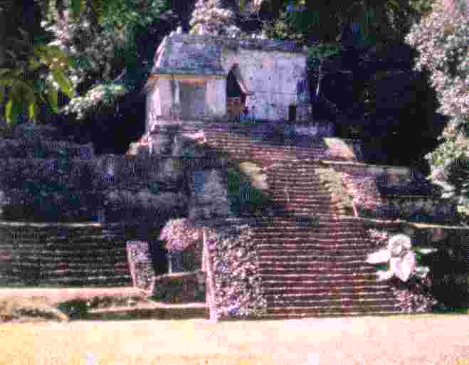 A Small Pyramid and Temple | 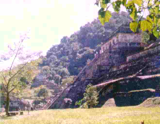 Main Pyramid and Temple Hill behind may be a larger |
|---|---|---|
 Unrestored Pyramid Corner Notice the Block Size |  The Cenote The City Water Works | 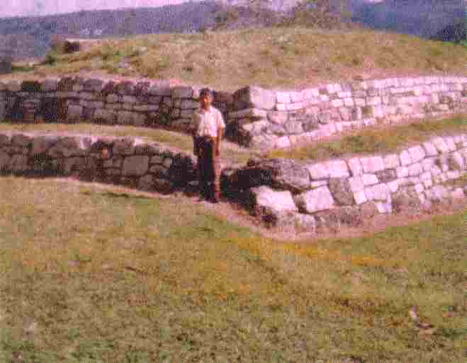 Guillamo - "Gia" My Trusty and Worthy Guide |
I returned to the highway and on into Comitan, a fairly modern town of about 32000 souls, lots of bromeliads in the trees but I saw no orchids. Filled up at Pemex, had Bistec ala Mexicana. The day has been cool, 50°, a great relief from previous days. I debated taking the back road to Palenque, but decided to ride on to San Christobal and Ocosingo and the Tonino ruins. There are ruins all over the place, undug - who knows what will be found???
Climbing out of Comitan on good road, 3-5% steady grade, it is bordered by ancient terraced fields, small 1/2 hectare plots, the corn being planted and harvested as in ancient times, allowed to dry on the stalk. As I crossed the ridge, this thought recurred. The soil in much of Mexico is good fertile volcanic soil, and lots of water most places, coming down from the high mountains. What limits Mexico is, 1.) A mixture of Indian/Spanish culture, and 2.) The fatalistic Catholic myths and religion blended with the myths of the ancients. Of course, these have worked for centuries to survive, if not progress, 100 years or more behind, even with cars, trucks, tractors and fair roads. It has produced a sturdy, healthy and for the most part a gracious, honest and hardworking folk.
Over the mountain and though the hills, coming down into Ocosingo, the countryside turned lush, a small town but clean. Mountain folk are a lot less trashy and junky than city folk. Men, women and boys were busy toting firewood into town with tumpline slung back loads. Out of Ocosingo about 5 miles I stopped at a little roadside park under a falls with pools that families and kids were enjoying in the afternoon. Somewhere I missed the turnoff to the Tonina ruins - Darn!!
It was a long, beautiful, lush haul over the mountain to Palenque, good road, a biker's dream if you into well banked close spaced hairpin turns. Coming into Palenque, it is flat jungle to the north as far as you can see. I circled around the town of 65000, fairly clean and tourist friendly. I went out the road toward the ruins just before dusk, found a campground and restaurante, had 2 excellent hamburgers and 2 sodas for $25p. I talked with Dave and Seb from Canada who were guiding rafting tours on the Agua Azul river. The campground was composed of about 12 individual "cuartos", bungalows, a kitchen, dining area and of course, places to set up tents.
Talking with Dave, he said that a laborer here makes $20-$30p per day plus a beer and a meal, less if given a cuarto - $3p-$4p per hour. Food is plentiful, corn everywhere, the jungle providing a bunch of things. The people are well clothed and clean, seeming to be relatively serene and happy. It was early, waiting for breakfast, but I could hear things coming alive. A young man and girl were at the far end of the dining palapa making little loving sounds and laughter. An Indian artist was beginning to work at painting "Mayan" murals on the front of one of the bungalows. All were being decorated with the murals, very striking and beautiful. As I looked around, the compound appeared to be solar powered, a number of solar panels on poles and I can hear a refrigerator running. A truck load of blocks came in the drive. They appear to be cut sandstone, 4x6x12. The grounds here are very neat, well landscaped, the bungalows white stucco, whitewashed, and thatched well. I see a girl working at smoothing out one of the paths with a hand forged grub hoe, a common implement here. It appears that she is just learning to handle pick and shovel. The birds were singing, sounds like some sort of mockingbird. A nice morning.
(I notice that as I have been typing that I have switched frequently from past to present tense... I have been reliving the journey as I work my way through my notes and log, and it sometimes gets real present time... the memory of those days is very much alive.)
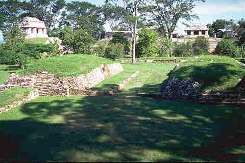
On visiting Palenque ruins I was most impressed. A lot of the original frieze work remains. It must have been a truly beautiful city when the Spaniards arrived. The east pyramid must have been an administrative center. It is honeycombed with passageways and small rooms, with courts and plazas with stepped terraces and shade trees all around. The temperature is very pleasant with a slight breeze. Down the west side meanders a very nice brook, apparently channeled at one time, lined with giant elephant ear plants with 6' long by 4' wide leaves. I would guess that the ruins cover about 10-15 acres. The main pyramid is marvelous, with a steep stair well down from the top to the burial sarcophagus of the chief. It is most remarkable as the cover is a solid slab of rock about 8 feet wide by 15 feet long and a foot thick, carved around the edges with masks. It is no place to be if you have claustrophobia or a weak heart. It is a stiff climb down and back up and stifling. I walked out the east side into unreclaimed jungle and ruins of walled terraces, apparently areas for living quarters, palapas, etc., covered with bromeliad, orchids, both air and terrestrial, and philodendron, none in bloom.
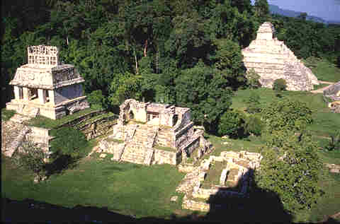 Palenque Panorama Photo 1 | 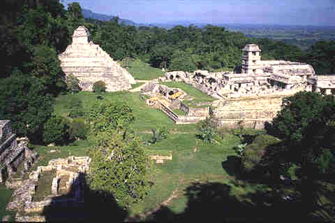 Palenque Panorama Photo 2 | 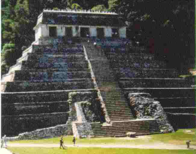 Temple Of The Inscriptions ... |
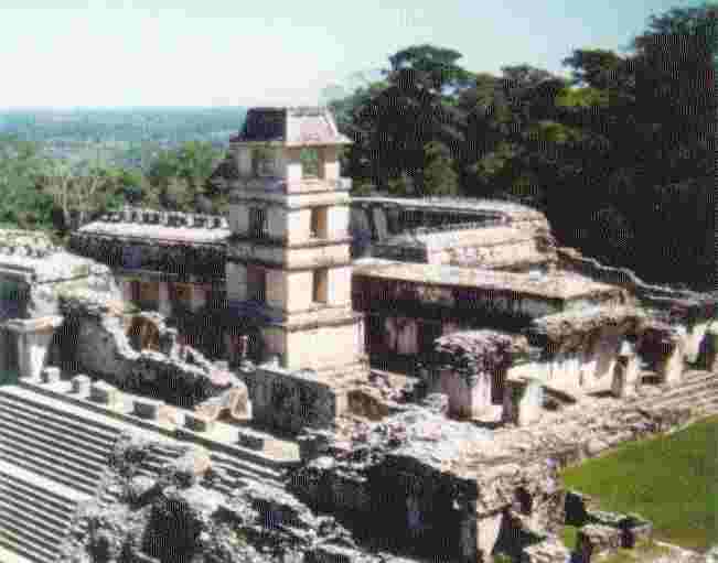 Tower Of The Winds From the Temple | 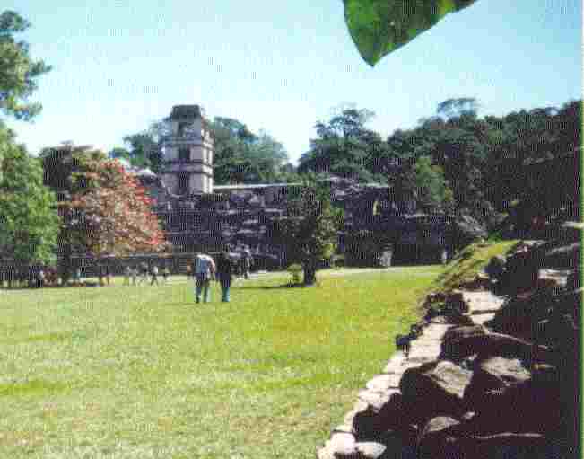 Tower Of The Winds From The Plaza | 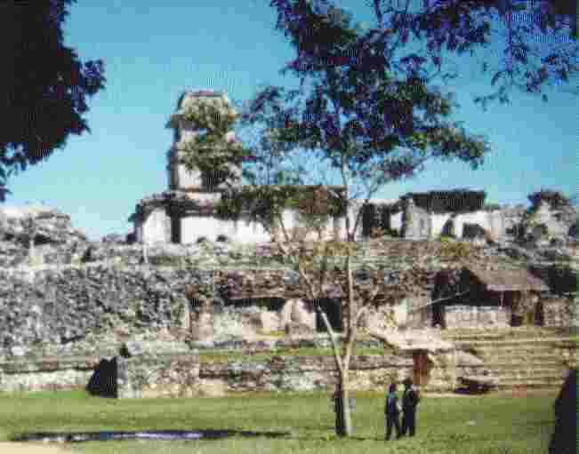 Tower Of The Winds From The Other Side |
 Ceremonial Ball Court | 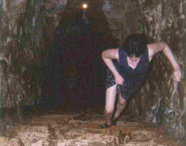 Climbing Up From The Tomb | 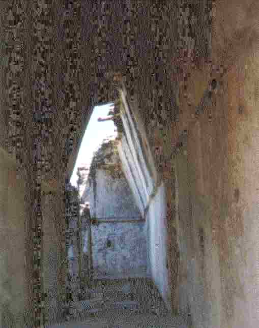 Vaulted Arch Passageway |
Go to this link for a Virtual Palenque Tour. You will need Quicktime Plug-In Installed in your Browser. Installation Instructions are in the Virtual Tour Help Page.
In my wandering and climbing around during the heat of the day, I got heat stroke after returning to camp. I laid down and slept about 3 hours. When I awoke I sat around the dining palapa, had fresh cantaloupe and other melons, and a Fresca. I was still woozy. I returned to my tent, slept, waking several times during the night. In the morning I was feeling OK, better, but a little weak. I broke camp and headed out though Palenque north toward Campeche.
The plain is rolling and rich, similar to east Texas, then flat for miles, tall grass prairie, mostly grazing land to Zital. As the road turns east toward Chetumal the land again rises and rolls a little. I filled up at Escarcega, and a lunch of Carne Asada Mexicana, explained to the waiter how slow I was learning Spanish, showed him my books and the route that I had travelled. The lunch and service was excellent, even toothpicks on the table. The salt was coarse sea salt, which I needed after the heat prostration. I was 150 miles out from Chetumal and maybe 120 out of Kohunlich Ruins. There are three ruins before Kohunlich; Chunjabin, Chicanna and Becan.
When I stopped to rest my butt about 45 miles out of Escarcega, a caravan of RVs and trailers going to Palenque went by, about 20 in the string, from British Columbia, Alberta, Montana, California, Arizona, New Mexico and Colorado. Up to that point I had the well maintained road pretty much to myself since Escarcega, travelling at 55-65mph.
I stopped at the Chicanna ruins, was guided by Serai, the daughter of the gatekeeper, delightful 18 year old teenager. The ruins were small, discovered in 1966. The carvings were well preserved with an impressive Eye of the Serpent god.
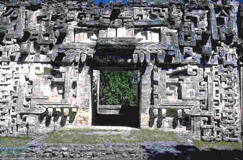 PORTAL with OPEN JAWS constructed of stone mosaic | 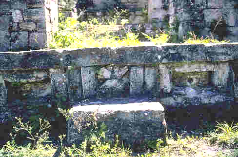 Jaguar mask of step/altar constructed of stone mosaic | 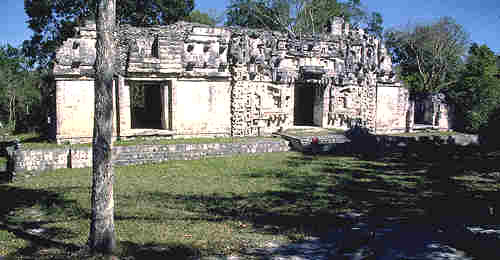 Ceremonial Portal Main Plaza |
|---|
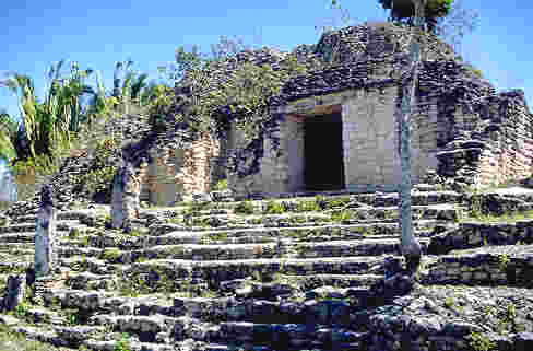
Down the road a few miles - Kohunlich - my favorite of all the trip - and I was out of film. Kohunlich is in a gracious park setting of the highest order, among a grove of magnificent Cohune palms (Orbignya cohune). It had wonderfully cut and squared stone. It appears that the stone is dolomite limestone, not uniformly cut but close, tightly bonded with lime mortar. The site is composed of 3 or 4 time period levels of occupation, the earliest appears to be of the highest craftsmanship. The Cohune palms are unusual, the fronds starting low from the base and extending 30-45 feet steeply up, very graceful and beautiful. This is the only place that I saw them. Here are some stock photos of Kohunlich.
 A small temple Cohune Palm In Left BG | 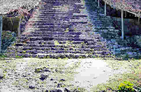 Marvelous Maya Masks still Adorn the Main Temple under awnings | 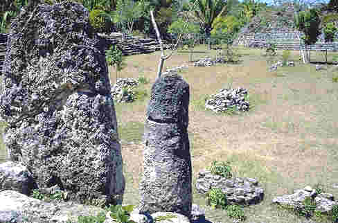 Stela, Main Plaza and an unexcavated Ball Court |
|---|---|---|
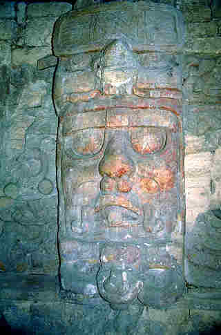 Maya Mask still showing traces of original color | 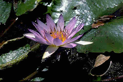 Lotus Flower blooming in Pond at Kohunlich |  Cohune Palm from eye level The fruit is hard, 8 cm long |
The roads in Quintana Roo are excellent, wide, shouldered like those in Texas, actually 4 lanes. Coming into Chetumal was a 4 lane parkway like those in the States, landscaped. As I entered Chetumal it began to rain, the first on the trip. I found a motel within two blocks, $135p as fine as any in the states for $50US, clean, air-conditioned, cable TV, HOT shower, nicely appointed and the bike was undercover in a closed garage. I reviewed my cash situation, $1125 pesos $112.50 US with 6 days to go until my check is available at the ATM. After much calculation, I figured I could make it to Merida with a little to spare.
I sat in a outdoor restaurant, talked with Markel and Letha from Holland, steered them toward San Augostino, a nice couple. I walked around a bit, there was a park and playground for kids across the street, grandma feeding hotdogs to kids, tire swings, log seesaws, swinging bridge, etc.. The town is very clean and orderly. I put too much salsa on my torta and got an acid stomach.
In the morning, slow getting dressed and moving into a beautiful day, I got my clothes washed. As I was packing up, a Mexican from D.F. videoed me and the bike and we had a nice talk. They apparently don't see Goldwings down here, I had seen none and only one Harley and that far north. As I was walking around, some of the Mayan women were surprisingly beautiful - 10% - the rest??? - too many corn tortillas.
Well, HP handed me a "lay day" here in Chetumal. I had left my clothes in the laundromat, thinking I was to return after 9am to pick them up. Arriving at 10 I found that they had closed for a Fiesta Day and political speeches - so much for that. In the mean time I rode around Chetumal, finding a place up the bay to camp - beautiful bay, no swell, no surf, totally protected. I saw that most all businesses were closed, but the printshop for political bulletins and posters was running full speed day and night. I rode up along the bay to Calderita, about 10 klicks. The bay front road frontage is being developed as parks for the people, no sign of "California" developers. At one park I sat in the shade of one of a series of palapa restaurantes enjoying the nice breeze off the bay, a few people drifting in about noon.
The bay must be very shallow, no deeper water colors. I saw fishermen in the bay casting sling nets, little better than waist deep out 200 meters. From where I sat I could see the head of the bay, but the outer reef was over the horizon. I wore away the day sitting in the shade, pleasantly doing nothing. It is a perfected art form and takes a lot of practice. A song came on the radio in the palapa "Gracias, Senor, por esta dia de mi vida, Gracias mi Dio", "Thank you, Sir, for this day of my life, Thank you, my God".
The music started in the palapa where I was and it was too much, demasiado, and I had to move to the next palapa to get away from it. There I had shrimp salad for lunch, camarone ensalada, a dozen butterflied shrimp and french fries, papas de francia, lettuce and carrot salad, beans, frijoles negro y tortillas..every meal has a stack of maize tortillas. Including 3 cokes it came to $40 pesos. I continued the afternoon studying my Spanish books, estudiendo mis libros de Espanol.
A group showed up around me, hung a hammaca, lit a fire, cooked their meal, the kids playing in the water at the sea wall. The water was only butt deep to a four year old. Kids at play the world around are the same in their activities and imaginations --- We are all ONE, until as adults we are MIS-TAUGHT different.
A 6 year old teaching her younger sister to float, the teasing, splashing, yelling and laughter, chasing in and out, up and down are the same - Oh, That we should become as little children, each in our own world and together as ONE.
Two more kids joined in, still ONE....
I sat there for nearly 6 hours doing nothing, fairly good practice, not perfect but improving. Did you know that the Mexican peso is the same diameter and thickness as a US nickel?
I finally determined that I had finished my job of doing nothing, rode back into town, scouted around, went into and sat in front of a museum for a half hour, walked around, then went out of town toward Escarcega about 15 klicks to a quarry and made camp facing north about 300 meters from the highway.
I woke at dawn to the birds gabbling. The dew was heavy and the humidity high. The tree I was camped under was some sort of mimosa. The quarry of dolomite lime is about 10 acres, 20-100 feet deep, and lush around it, apparently used to supply material to build the excellent road to the west of my location. Looking at the edge of the quarry, the topsoil is quite thin and poor. I am still surprised (and pleased) at the paucity of insect pests, almost none, few mosquitoes and flies. When it came time to break camp it took me an hour to sun dry the tent, fly and tarp. It didn't get that wet in Alaska in the rain.
Into Chetumal, picked up my laundry, rolled and packed it in the scoot boot, and up the road along the coast toward Cancun, stopping at Felipe Carrillo Puerto for my morning meal. I talked with a Texas rancher and his mother (80) there for an hour. He has been ranching in Chihuahua, Quintana Roo and Guatemala for the last 20 years, and she has been successfully doing real estate in California and here. Both are allied with the "Patriots" and the Spotlight bunch.
I continued on to Tumul Ruins. It was a beautiful walled city, covering about 30 acres, backed by the cliffs down to a beautiful Caribbean beach. Built of volcanic stone, fairly crude, about 1400-1600 on a volcanic outcrop/fissure. All else around is limestone.
 Main Pyramid - Tumul The CASTLE circa 1350AD |  The CASTLE and other Temples |  The Archaeological Zone from Inside the wall |
|---|---|---|
 The beach from the top of the castle |  The Castle from the beach |  The Beach - People still playing on it 700 years later |
Out of Tumul, I arrived in Cancun about 5:30 on very excellent new concrete 6 lane freeway. The motorcycle turned 70,000 just at the edge of town. Cancun is a tourist MADHOUSE, prices high. I got out of Dodge and into the locals section in a few miles, found a good little tortilleria and a nice family, had fun trying to communicate. They had a picture of an old shaft drive Indian Chief on the wall of the eating area as a decoration. The Torta Pierna excellant and picante. Mama and Papa were figuring their books and doing new menus, very neat and artistic printing and sketches. Their kids were helping, son about 16, daughter about 14, The family of Giron Ruiz. The kids got their chores done, sweeping and cleaning, and the son sat down on the steps, absentmindedly wiggling his ears..everyone laughed..... The oldest son came in about 8... It seems to be a very happy family and everyone is included. The middle son finished his practice wiggling, got up and started cutting up supplies for the morning business, cheeses, tomatoes, etc. and started making more tortas for the eldest to deliver. Phone orders...
I camped on the beach north of Cancun at Punto Sam next to a boat yard. It was on a lot where someone had started a foundation. I could see the lights of Cancun and Isla Mujeres across the water. I slept well, woke twice in the night by kids coming out to neck or....?
Travelling back through Cancun in the morning, I saw all of Cancun I want to see.... Found the free road toward Merida and Chichen Itza stopping about 30 klicks out for breakfast of fruit and coffee...the fruit made a good breakfast, especially as I had too much jalapeno picante on my sandwiches for dinner. Checking my money, $680p. Chichen Itza is just up the road, which has a very uneven surface but not badly potholed.
I stopped at Valladolid in the zocalo and had coffee. Valladolid is a clean busy town with a very nice zocalo. Just before Valladolid about 5 klicks I saw the first two windmills pumping water in all of Southern Mexico. I had been wondering why I hadn't seen any when I passed through little hamlets and pueblas that were drawing their water from wells with a bucket on a rope. The area has many palapas along the road, in typical slash and burn, poke a stick in the ground farming of corn and melons.
I had been having a wiring problem with the tail lights on the scootboot, the ground wire had come undone somewhere. I found it under the saddle, it had come unplugged...fixed. I walked around the zocalo and visited an old Spanish church which is being restored, as imposing a structure as any in the Mayan ruins. I got myself a homemade, spin it cold in a hand crank salt and ice freezer, strawberry ice cream cone, with big chunks of strawberry, and got my boots shined. Wandered around some more, then had a super club sandwich for lunch.
On to Ek Balam. A fellow named Asuncion was my guide. This ruins is unusual as the terraces are circular on the ends and are of fine quality with native stone. It is in a nice setting. At the back of the compound is the beginning excavation of the front base wall of a pyramid. It is like a warehouse front 200 meters long. The pyramid is about 200 x 200 and about 40 meters high. The ball court was also unusual, having sloping ramps extending 5 meters from the scoring wall and target. You can see the ramps and target in the photo. The target is a stone hoop extending from the wall with a hole through about a foot in diameter.
 Warehouse Wall At Base Of Pyramid | 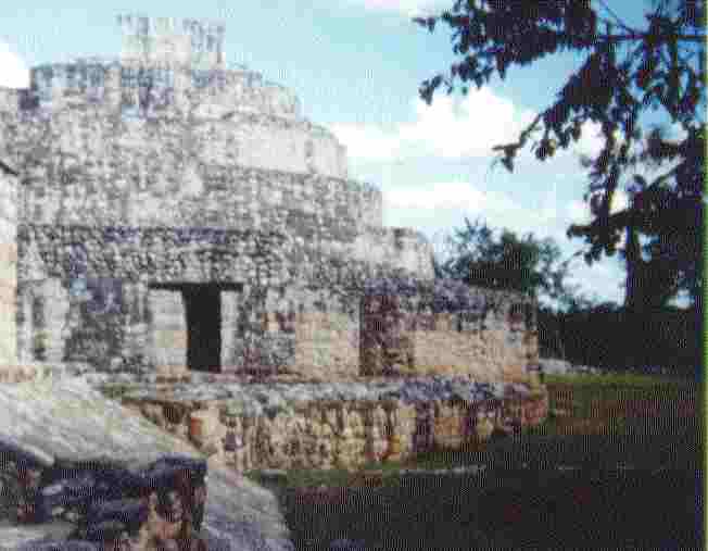 Rounded Ends Of Pyramid Terraces | 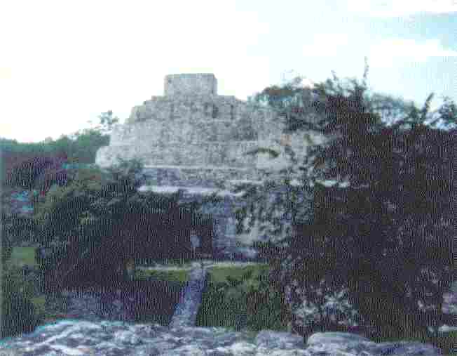 Ek Balam Pyramid From Across The Compound |
|---|---|---|
 The Ceremonial Ball Court Note The Sloping Ramps | 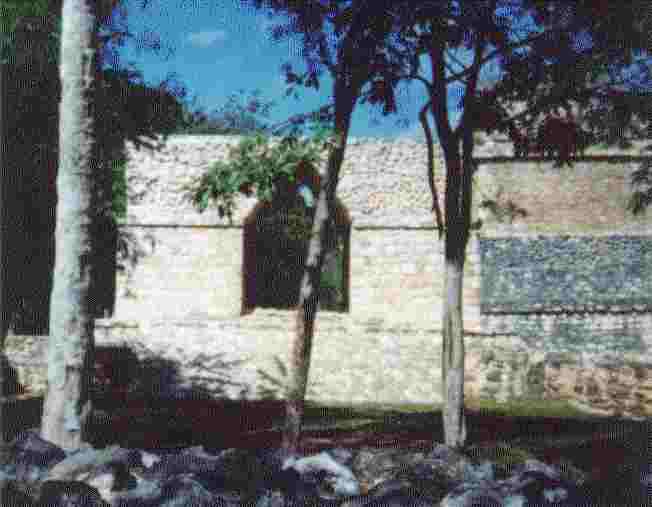 A Mayan Vaulted Arch From One Court To Another |  AN UNEXCAVATED RUINS All Mounds On The Plain Are Ruins |
Leaving Ek Balam, I turned left to the north, came to the village of Ek Balam, still as Mayan as ever, palapas and hammacas, and then 200 meters outside of the village, a Baseball Field, complete with backstops, bleachers and 4 teams playing in uniform!!! I followed a dirt road in the direction of the main highway for about 10 klicks, then right to Tisimin, a real nice town, clean, zocalo, shade and a Pepsi. The typical Spanish church fronting the zocalo dates from 1749. Tizimin is apparently a fairly affluent ranching community, as I saw cattle ranches coming into town and a couple of mechanized farms with more windmills..
Past Tizimin about 5 klicks is Kikil and when I arrived a community fiesta was in progress. An improvised bullring was set up, with amateur toreros, a bull calf, a brangus, scared of the men - 8 men and boys scaring the crap out of it. The "bull" finally squeezed through a gap in the fence and was gone. People having fun...
I went on to Rio Lavarto and circled town looking for a camp spot..back across to San Filipe, the northern most in Yucatan, a fishing/ranching community, circled town, found a place to camp, but then a roar from town...back to town and the arena. I paid for a ticket to the bleachers. An exhibition of well trained parade horses being put through their paces, bowing and curtseying, laying down and getting up with their riders. After there was a bull fight with Toreador and Toreros in "Suits of Light" and all the glitter. About a 2 year old bull entered the arena. A vaquero came out and roped the bull and dragged him back..apparently an escapee.
A 2nd bull entered the arena, about 2 1/2, confused, not at all aggressive, poor damn animal just wanted out, walked over to the gate and put his head down. But the toreros were having fun and tried to excite him, no soap, nada. The vaquero made 3 throws and caught him by the horns, but couldn't drag him to the chute. Finally the bull ran him behind the safety wall, then made a beeline for the open gate on his own, trailing the riata the vaquero had dropped...Good show and everybody had a good time, emerged from the bleachers and went to the band stand, gathered around, laughed, clapped to the music, danced, and cheered. Luis Gilberto Selmonforte came by and bent my ear about Klinton in Mexico, D.F. and in Tizimin...they don't like him any more than we do....
Then a kootch dancer came on stage - middling good looking, a fair dancer, but a little heavy in the butt. A couple of little cute 8 year old kids came by and said hello and goodbye at least 3 times... practicing the English they are learning in school. Men and women, boys and girls and kids all gathered around and having a good time. One young man, about 22, tried to trade me out of the motorcycle, they had never seen one larger than a 250cc Honda.
I decided to ride on in to Panaba. Everyone in town was in the zocalo. I suddenly realized it was Sunday night. Every Sunday is a grand night in the zocalo in Mexico.. One grand, great big happy family. Here too, the Goldwing was the first big bike to arrive in Panaba. I left the excitement of Panaba and the crowd gathered around me about 11pm and made a camp about 20 klicks away in a grassy lane leading to a cattle water trough. It was all quiet, nice, I like quiet.
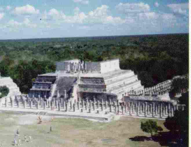
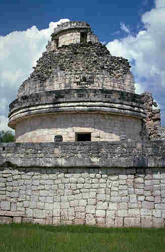
On to Chichen Itza, after drying out the tent fly in the morning, through Espita and Dzitas, arriving at Piste near the ruins for coffee, ham and eggs, about a mile from the ruins. Chichen Itza, the most important ruins in Yucatan, partly Toltec 900-1200AD and partly Mayan 500-800 AD, naturally has excellent, modern facilities to accommodate tourists, of which there were few this morning. The grandeur of Chichen is best described by the photos. I talked with 3 English girls from London and Severn for about a half hour. Most of C-I is made of cut limestone. I climbed the interior passage of the pyramid to the top, first in of 20, been there, done that, 100°/100%, and leaned in the shade and breeze of the temple on top to cool off for half an hour. After climbing down from the pyramid, I walked down to the Sacrificial Cenote - The Mayan Birth Control Center. Then because it was so hot, I got a liter of water and sat in the shade of a palapa, talking with a fellow from Michigan and his two daughters. He had toured the Andes and Machu Pichu .. he says "That is It". I climbed the great pyramid, walked around and through the temple and took panoramic shots down and over to the Temple of the 10000 Warriors. The columns are carved or were stuccoed and painted. The "Zompontle" or skull rack is elaborately decorated with Skull Masks, and was once adorned with real polished skulls of their captives. Surrounding a more or less square 250 meters on a side - the Zocalo of Chichen Itza, I found the foundations of a number of palapas 8m x 20 m and piles of stones, carved and many sided, apparently parts of upper structures and roof combs, that the archaeologists and restorers have neatly numbered and cataloged, but not yet found a fit for, cylinders by the score, 10" diameter x 20" long, decorations or supports of some sort. I wandered out and about the backside of a few unrestored small pyramids and structures, overgrown with plants and trees. I found a cave arched over with volcanic rock, from which the limestone has been excavated apparently in ancient time. Coming out of the dense undergrowth I came upon a typical mud and wattle Mayan Palapa, apparently the dwelling of workers in the compound. I ran out of film again when I reached the observatory, three concentric towers with interior spiral stairway to the top. To the west is another massive stucture with high walled base and fairly massive step stones carved walls and several entrances, the so-called "Nunnery", honeycombed with chambers and tunnels. A Mexican guide came by, showed me some sketches made in 1836 that show the nunnery and the iglesia as they are today. He said the big hole in the nunnery is from dynamite, the thieves looking for loot. Beyond was a sign pointing the direction to Chichen Itza Viejo, extending for 6 km. This was no small village. Chichen Itza would take a month or more to explore fully, or years. I watched from the shade as 4 lads, one obviously the superintendent of their work, carefully worked at the restoration of a small pyramid. The amount of work done in restoration by the modern Mexicans very nearly equals the work done in building. They have done a marvelous job of piecing a giant puzzle back together.
Chichen Itza History
A MAYA center in northern Yucatan (Mexico), became the capital of a large state during the TOLTEC domination in the 11th and 12th centuries. The name means "mouth of the well of the Itza" in Yucatec Maya. A small farming village was established at Chichen by about 500 BC. By AD 700, the site had become a substantial civic-ceremonial center. Pilgrims came from afar to cast offerings into Chichen's cenote, a natural well sacred to the rain god. Palaces, temples, and even an astronomical observatory built in the Puuc style of Maya architecture point to relations with UXMAL to the west. In AD 987, Toltecs from central Mexico, led by a man named Kukulcan, an alternate form of the name of the Toltec deity QUETZALCOATL, took over Chichen. Aided by the Itza, a Mayan people from the Gulf Coast who had already made inroads at Chichen, the new rulers quickly dominated northern Yucatan and built Chichen into a hybrid Toltec-Maya capital. The focus of the new civic center was the Castillo, a temple-pyramid dedicated to Kukulcan. The nearby Temple of the Warriors echoes the design of an important temple at TULA, the Toltec capital in central Mexico. The largest ball court in Mesoamerica faces the Temple of the Warriors across a great plaza, from which a causeway leads to the sacred cenote. More temples, ball courts, and causeways, along with palaces, dance platforms, and sweat baths, fill out the public sector of Chichen. The murals and reliefs that adorn most major buildings give information about Chichen's history and organization, especially the relations between the Maya and their Toltec overlords. In the late 12th century, the ruler of MAYAPAN led a revolt that brought about the sack of Chichen and Mayapan's emergence as the new capital. The Itza fled south to Lake Peten Itza and established the town of Tayasal, where their descendants remained independent until 1697. Chichen never regained political importance, but the cenote cult flourished amid its ruins, even after the Spanish conquest. Early colonial documents and traditional Maya histories complement the archaeological record with a wealth of information about Chichen's role in the history of Yucatan. Excavations at Chichen, mainly by the Carnegie Institution of Washington and by the Mexican government, have emphasized exploration and reconstruction of Toltec period remains.
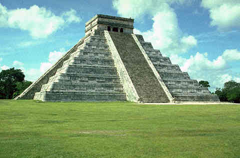 El Castillo Pyramid The Pyramid of Kukulcan | 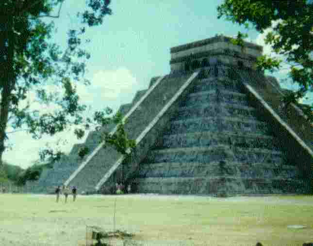 El Castillo Another View | 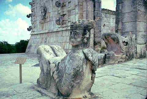 Chac Mul, The Maya Rain God A Reposing Sacrificial Altar |
|---|---|---|
 Temple of the 10000 Warriors From El Castillo | 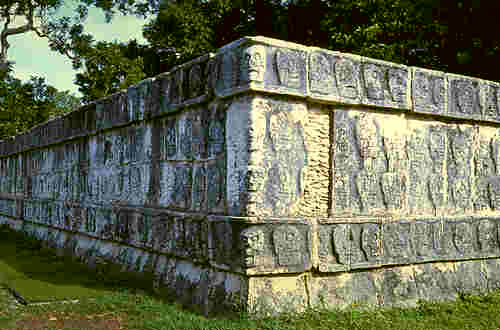 Zompontle, 900-1200 AD The Skull Rack |  Pieces of the Puzzle There are many piles like this |
 El Caracol The Celestial Observatory | 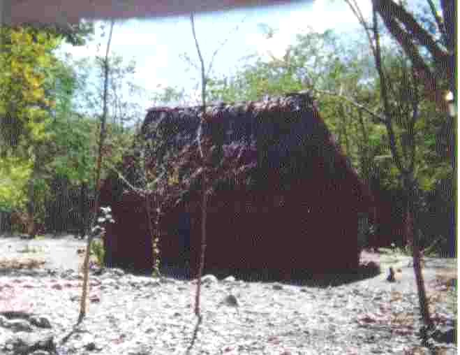 Typical Mayan Palapa Thatched Roof, Mud/Wattle Walls |  Looking across into Sacrificial Cenote (Well) |
As I wandered back toward the main gate, I came across a palapa restaurante, welcome shade, a Coke and a smoke. I wandered on to the main gate and out - got on the cycle - been there, done that!!!
The road on to Merida was good, arriving at the zocalo in the center of town about time for dinner. The zocalo fronts a beautiful big church 400+ years old in excellent condition. Merida is a beautiful modern city of 700,000, its older sections of old Spanish 400 year old churches and structures. There were bands playing around the zocalo, marimba, guitars, fiddles and drums. I watched the crowd as I had the cycle washed. The girls (some) here are surprisingly long legged and lithe, but some still have the Mayan countenance, and of course the small short squat Mayan women abound. I bought myself 2 tortas, barbacoa con queso that were probably the best sandwiches I have ever eaten and 2 manzana sodas, I was dehydrated. I left Merida about 8:15 and headed out toward Campeche, stopping at Uman to see the magificent old church, as imposing a stack of rock as any other Mayan rock work. I camped off the highway about a half mile off in an orange orchard south of Uman about 20 km.
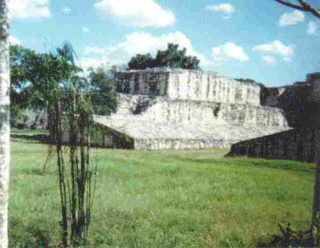
It took 2 hours in the morning to dry the tent and gear from the dew. The orchard campesino came into the orchard about 7:30 and we talked a little, then he was off to work, pruning and irrigating. I left at 8:30 toward Uxmal ruins, shot a picture of the pyramid from a distance, but I had to pass up going in as I was down to $80 pesos, with this day and night to go before my check would be deposited so I could visit the magic money machine.
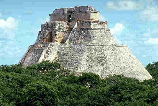 Sorceror Pyramid |
|---|
Down the road to Sta. Elena, population 2500, with an imposing old church from the 1700s on the hill. The clock on the top of the Palacio Municipal was right on, chiming 1/4 hours and speakers providing music for the entire town. The streets were dirt, but clean. Scabbied old dogs wander around. Dogs are not fed, they scrounge for themselves in Mexico.
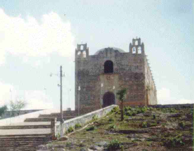 The Church at Santa Elena |
|---|
About 5 klicks out of Sta. Elena, the ruins of Kabah are alongside the highway. I took a few shots from outside the gate. I was there about 20 minutes talking with folks from tour buses from Texas, carrying gringo tourists from all over the US.
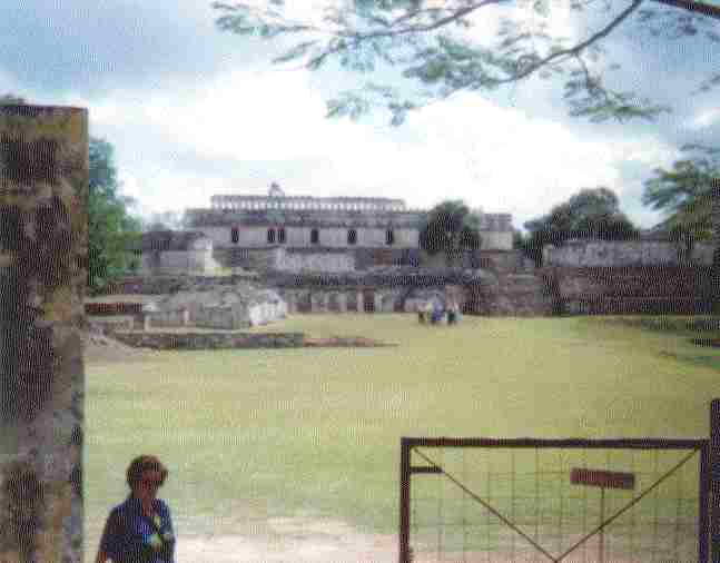 The Central Structure at Kabah | 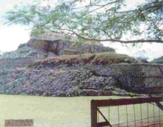 The Castle at Kabah |
|---|---|
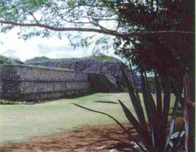 The Front Wall | 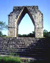 The Arch at Kabah |
This page is getting slow to load and as I am turning the corner on the way north from the Yucatan Peninsula and moving out of Mayan Country, it is time to go to a new page.
 |
|---|
 |
|---|